Area Overview for Llandyrnog Community
Photos of Llandyrnog Community

Area Information
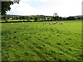
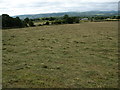
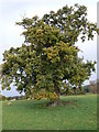
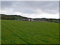
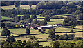
Llandyrnog Community presents a very specific residential character within the unitary electoral division of Wales. The area covers a total land mass of 18.1 km², a size that allows for a contained environment rather than sprawling urban development. When you consider living in Llandyrnog Community, you are entering a location defined by its age demographic and established housing stock. The median age here reaches 70 years, indicating a population settled over time rather than a transient community. This demographic focus shapes every aspect of daily life, from local shop openings to community event scheduling. The area does not advertise itself through bustling nightlife or rapid gentrification, which aligns with a population that values stability over change. You find practicality when you look at homes in Llandyrnog Community, as the housing market reflects long-term residents who have stayed put. There is no pretension to find in this setting; it is a straightforward geographic zone where life moves at a pace suited to its inhabitants. The area's identity is clear and unambiguous. It serves those who understand the value of a quiet, homogenous environmental setting without the distractions of major development pressures.
- Area Type
- Parish
- Area Size
- 18.1 km²
- Population
- Not available
- Population Density
- Not available
Demographics
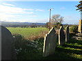
The social fabric of Llandyrnog Community is defined by an exceptionally mature population. Residents here have a median age of 70 years, a figure that clearly distinguishes this locality from typical national averages. When you examine houses in this area, you will find they are predominantly the homes of retirees or long-term pensioners rather than families with young children. A significant majority of the population are homeowners, with a home ownership rate standing at 73 per cent. This high level indicates that most people have lived in their properties for decades, resulting in deep-rooted community ties. The community is not characterised by frequent turnover or rental speculation. Accommodation types reflect this stability, with physical structures built years ago to meet the needs of the local workforce and their families generations back. You do not see large concentrations of rented social housing or temporary lodging here. The racial and religious composition is not detailed in current records, so you should assume a historically established demographic profile without expecting significant recent shifts. For a buyer, this means a homogeneous environment where social norms are well understood. You are entering a sphere of residence where the priorities of the current residents align closely with preservation and quiet enjoyment.
Household Size
Accommodation Type
Tenure
Ethnic Group
Religion
Household Composition
Age
Household Deprivation
NS-SEC
Explore more demographic insights in this area
Go to Demographics tabPlanning
Planning Constraints
- Flood RiskPremium
- Ramsar Wetland SitesPremium
- Area of Outstanding Natural BeautyPremium
- Protected Nature ReservePremium
- Protected WoodlandPremium
- Crime RiskPremium