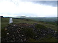
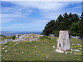
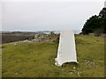
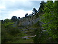
Area Overview for Llanddulas and Rhyd-y-Foel Community
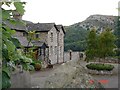
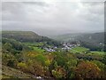
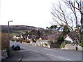
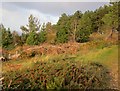
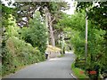
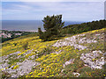
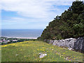
Photos of Llanddulas and Rhyd-y-Foel Community
Area Information
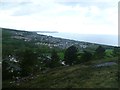
Living in Llanddulas and Rhyd-y-Foel Community means settling into a compact civil parish covering just 5.6 square kilometres. This small area lies within Wales, offering a defined sense of place rather than sprawling urban expanses. You will find a neighbourhood where daily life moves at a measured pace, removed from the intensity of major cities. The community functions as a self-contained unit where residents enjoy complete knowledge of their immediate surroundings. Those considering homes in Llanddulas and Rhyd-y-Foel Community should understand that the boundaries are set, creating a distinct shelter from the wider region. The area supports a traditional rhythm of living where locals know one another simply through proximity. Visualising life here involves a focus on the immediate landscape rather than distant horizons. You step outside your door and see what defines the parish rather than navigating complex transport networks. This compact size influences everything from noise levels to the ease of walking to local amenities. Prospective buyers value stability and recognise that smaller communities often offer predictability. The parish structure ensures that local decisions affect the area directly without dilution by larger administrative bodies. When you buy a home in Llanddulas and Rhyd-y-Foel Community, you acquire a stake in a recognised locality with clear boundaries. This clarity helps you understand exactly where you are living within the broader Welsh geography.
- Area Type
- Parish
- Area Size
- 5.6 km²
- Population
- Not available
- Population Density
- Not available
Demographics
The people of Llanddulas and Rhyd-y-Foel Community reflect an established settlement pattern with a median age of 70 years. This figure indicates a population dominated by older adults, suggesting the area serves as a resting place for those retiring from active careers. You are looking at a community where households likely consist of older couples or individuals living independently. Data shows that 80 per cent of residents own their homes outright, with only small portions remaining in other tenure types. This high ownership rate contradicts modern rental trends, pointing to deep-rooted stability among the inhabitants. Household composition in the area mirrors this demographic reality, with families typically formed around older generations rather than young parents or shared housing arrangements. The accommodation types reflect this, though specific breakdowns of bungalows versus detached houses are not listed in the current statistics. You can expect a neighbourhood where residents have lived for decades, resulting in a quiet social environment. Diversity in terms of ethnicity and religion is not detailed in the available figures, meaning the community leans towards traditional local patterns common in rural Wales. Living here offers peace but requires acceptance of an ageing social fabric where the median resident is in their seventh decade of life.
Household Size
Accommodation Type
Tenure
Ethnic Group
Religion
Household Composition
Age
Household Deprivation
NS-SEC
Explore more demographic insights in this area
Go to Demographics tabPlanning
Planning Constraints
- Flood RiskPremium
- Ramsar Wetland SitesPremium
- Area of Outstanding Natural BeautyPremium
- Protected Nature ReservePremium
- Protected WoodlandPremium
- Crime RiskPremium