Area Overview for LL34 6NG
Photos of LL34 6NG

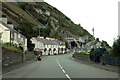
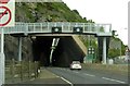
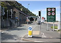
79 photos from this area
Area Information
Key information about the LL34 6NG including its size, population, and administrative classification.
- Area Type
- Postcode
- Area Size
- 2.7 hectares
- Population
- 1267
- Population Density
- 529 people/km²
House Prices in LL34 6NG
33
Properties
£92,337
Average Sold Price
£16,000
Lowest Price
£220,000
Highest Price
Showing 33 properties
| Address | Type | Beds | Baths | Last Sale Price | Last Sale Date | |
|---|---|---|---|---|---|---|
| 50 High Street, Penmaenan, Penmaenmawr, LL34 6NG | Terraced | 2 | - | £71,500 | Aug 2025 | |
| 59 High Street, Penmaenan, Penmaenmawr, LL34 6NG | house | 2 | 2 | £220,000 | Mar 2025 | |
| 43 High Street, Penmaenan, Penmaenmawr, LL34 6NG | Semi-detached | 2 | 1 | £155,000 | Jan 2023 | |
| Y Glynnog, High Street, Penmaenan, Penmaenmawr, LL34 6NG | Terraced | - | - | £95,000 | Oct 2022 | |
| Bryn Glas, High Street, Penmaenan, Penmaenmawr, LL34 6NG | house | - | - | £110,000 | Mar 2022 | |
| 41A High Street, Penmaenan, Penmaenmawr, LL34 6NG | Terraced | 2 | 1 | £117,500 | Sep 2021 | |
| 52 High Street, Penmaenan, Penmaenmawr, LL34 6NG | house | - | - | £79,000 | Apr 2021 | |
| 41 High Street, Penmaenan, Penmaenmawr, LL34 6NG | Terraced | 2 | 1 | £116,000 | Oct 2019 | |
| 47 High Street, Penmaenan, Penmaenmawr, LL34 6NG | Semi-detached | 2 | 1 | £105,000 | Mar 2019 | |
| 42 High Street, Penmaenan, Penmaenmawr, LL34 6NG | house | - | - | £75,000 | Nov 2017 |
Page 1 of 4
Energy Efficiency in LL34 6NG
Amenities
Schools
| Rank | School | Type | Entry gender | Ages |
|---|
Explore more schools in this area
Go to Schools tabDemographics
Household Size
One person
most common
Accommodation Type
Houses
most common
Tenure
61
majority
Ethnic Group
White
most common
Religion
N/A
most common
Household Composition
N/A
most common
Age
47
median
Adults (30-64 years)
most common
Household Deprivation
N/A
with no deprivation
NS-SEC
28
in Lower managerial occupations
Explore more demographic insights in this area
Go to Demographics tabPlanning
Planning Constraints
- Flood RiskPremium
- Ramsar Wetland SitesPremium
- Area of Outstanding Natural BeautyPremium
- Protected Nature ReservePremium
- Protected WoodlandPremium
- Crime RiskPremium