Area Overview for LL33 0TB
Photos of LL33 0TB
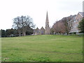

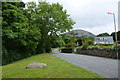
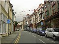

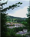
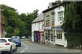


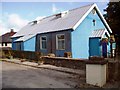
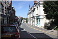

94 photos from this area
Area Information
Key information about the LL33 0TB including its size, population, and administrative classification.
- Area Type
- Postcode
- Area Size
- 1.4 hectares
- Population
- 1752
- Population Density
- 180 people/km²
House Prices in LL33 0TB
20
Properties
£154,350
Average Sold Price
£8,000
Lowest Price
£327,500
Highest Price
Showing 20 properties
| Address | Type | Beds | Baths | Last Sale Price | Last Sale Date | |
|---|---|---|---|---|---|---|
| Tan Lan, Nant Y Felin Road, Llanfairfechan, LL33 0TB | Semi-detached | 2 | 1 | £137,000 | May 2025 | |
| Tan Lan Isaf, Nant Y Felin Road, Llanfairfechan, LL33 0TB | Detached | 4 | 1 | £327,500 | Mar 2023 | |
| Dyfnant, Nant Y Felin Road, Llanfairfechan, LL33 0TB | house | 4 | 2 | £255,000 | May 2022 | |
| Cernyw, Nant Y Felin Road, Llanfairfechan, LL33 0TB | house | - | - | £94,500 | Jul 2019 | |
| Tal Y Braich, Nant Y Felin Road, Llanfairfechan, LL33 0TB | Detached | 3 | 1 | £105,000 | May 2010 | |
| Cefn Y Cerrig, Nant Y Felin Road, Llanfairfechan, LL33 0TB | Semi-detached | - | - | £215,000 | Mar 2009 | |
| Tan Y Fron, Nant Y Felin Road, Llanfairfechan, LL33 0TB | house | - | - | £73,500 | Dec 2007 | |
| Eryri, Nant Y Felin Road, Llanfairfechan, LL33 0TB | house | 3 | - | £139,000 | Apr 2006 | |
| Bryn Garth, Nant Y Felin Road, Llanfairfechan, LL33 0TB | Semi-detached | - | - | £189,000 | Dec 2004 | |
| Fron Uchaf, Nant Y Felin Road, Llanfairfechan, LL33 0TB | Detached | 3 | 1 | £8,000 | Oct 2001 |
Page 1 of 2
Energy Efficiency in LL33 0TB
Amenities
Schools
| Rank | School | Type | Entry gender | Ages |
|---|
Explore more schools in this area
Go to Schools tabDemographics
Household Size
One person
most common
Accommodation Type
Houses
most common
Tenure
63
majority
Ethnic Group
White
most common
Religion
N/A
most common
Household Composition
N/A
most common
Age
47
median
Adults (30-64 years)
most common
Household Deprivation
N/A
with no deprivation
NS-SEC
31
in Lower managerial occupations
Explore more demographic insights in this area
Go to Demographics tabPlanning
Planning Constraints
- Flood RiskPremium
- Ramsar Wetland SitesPremium
- Area of Outstanding Natural BeautyPremium
- Protected Nature ReservePremium
- Protected WoodlandPremium
- Crime RiskPremium