Area Overview for LL33 0NH
Photos of LL33 0NH
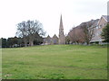

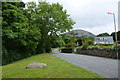
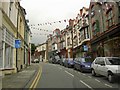
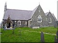
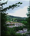
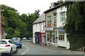
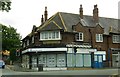
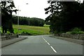
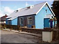
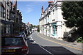

94 photos from this area
Area Information
Key information about the LL33 0NH including its size, population, and administrative classification.
- Area Type
- Postcode
- Area Size
- 8027 m²
- Population
- 1793
- Population Density
- 219 people/km²
House Prices in LL33 0NH
11
Properties
£240,000
Average Sold Price
£240,000
Lowest Price
£240,000
Highest Price
Showing 11 properties
| Address | Type | Beds | Baths | Last Sale Price | Last Sale Date | |
|---|---|---|---|---|---|---|
| Plas Newydd, Village Road, Llanfairfechan, LL33 0NH | Detached | 5 | 1 | £240,000 | Sep 2018 | |
| Flat 2, Coed Mawr, Village Road, Llanfairfechan, LL33 0NH | Flat | 3 | 1 | - | - | |
| Bankfield, Village Road, Llanfairfechan, LL33 0NH | retail_financial | - | - | - | - | |
| Maisonette, Manchester House, Village Road, Llanfairfechan, LL33 0NH | Maisonette | 3 | - | - | - | |
| Flat, Meirion House, Village Road, Llanfairfechan, LL33 0NH | Flat | - | - | - | - | |
| The Flat, Stafford House, Village Road, Llanfairfechan, LL33 0NH | Flat | - | - | - | - | |
| Meirion House, Village Road, Llanfairfechan, LL33 0NH | Detached | - | - | - | - | |
| Basement Flat, Manchester House, Village Road, Llanfairfechan, LL33 0NH | Flat | - | - | - | - | |
| Carlton (north Wales) Limited, Health Centre, Village Road, Llanfairfechan, LL33 0NH | primary_healthcare | - | - | - | - | |
| Glen Usk, Village Road, Llanfairfechan, LL33 0NH | house | - | - | - | - |
Page 1 of 2
Energy Efficiency in LL33 0NH
Amenities
Schools
| Rank | School | Type | Entry gender | Ages |
|---|
Explore more schools in this area
Go to Schools tabDemographics
Household Size
Two person
most common
Accommodation Type
Houses
most common
Tenure
79
majority
Ethnic Group
White
most common
Religion
N/A
most common
Household Composition
N/A
most common
Age
47
median
Adults (30-64 years)
most common
Household Deprivation
N/A
with no deprivation
NS-SEC
37
in Lower managerial occupations
Explore more demographic insights in this area
Go to Demographics tabPlanning
Planning Constraints
- Flood RiskPremium
- Ramsar Wetland SitesPremium
- Area of Outstanding Natural BeautyPremium
- Protected Nature ReservePremium
- Protected WoodlandPremium
- Crime RiskPremium