Area Overview for LL32 8YU
Photos of LL32 8YU
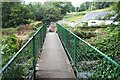
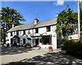
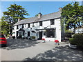
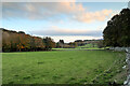
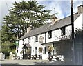
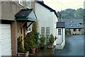
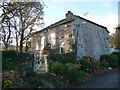
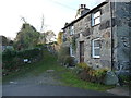

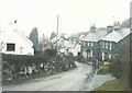
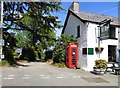
24 photos from this area
Area Information
Key information about the LL32 8YU including its size, population, and administrative classification.
- Area Type
- Postcode
- Area Size
- 6.2 hectares
- Population
- 1944
- Population Density
- 26 people/km²
House Prices in LL32 8YU
17
Properties
£149,063
Average Sold Price
£10,000
Lowest Price
£280,000
Highest Price
Showing 17 properties
| Address | Type | Beds | Baths | Last Sale Price | Last Sale Date | |
|---|---|---|---|---|---|---|
| Swan Cottage, Rowen Road, Rowen, Conwy, LL32 8YU | house | - | - | £190,000 | Sep 2021 | |
| 4, Yr Hen Berllan, Rowen Road, Rowen, Conwy, LL32 8YU | Detached | 5 | 2 | £265,000 | Jan 2020 | |
| Drws Y Coed, Rowen Road, Rowen, Conwy, LL32 8YU | house | - | - | £10,000 | Jan 2017 | |
| River View, Rowen Road, Rowen, Conwy, LL32 8YU | Semi-detached | 3 | - | £155,000 | Mar 2014 | |
| Dyffryn, Rowen Road, Rowen, Conwy, LL32 8YU | house | - | - | £192,500 | May 2007 | |
| Gwynant, Rowen Road, Rowen, Conwy, LL32 8YU | Detached | 6 | 4 | £280,000 | Jul 2004 | |
| Penycoed, Rowen Road, Rowen, Conwy, LL32 8YU | house | - | - | £40,000 | Mar 1998 | |
| 1, Yr Hen Berllan, Rowen Road, Rowen, Conwy, LL32 8YU | Detached | - | - | £60,000 | May 1996 | |
| Bwthyn Rhyd, Rowen Road, Rowen, Conwy, LL32 8YU | Detached | 2 | 2 | - | - | |
| 3, Yr Hen Berllan, Rowen Road, Rowen, Conwy, LL32 8YU | Detached | 3 | 1 | - | - |
Page 1 of 2
Energy Efficiency in LL32 8YU
Amenities
Schools
| Rank | School | Type | Entry gender | Ages |
|---|
Explore more schools in this area
Go to Schools tabDemographics
Household Size
Two person
most common
Accommodation Type
Houses
most common
Tenure
79
majority
Ethnic Group
White
most common
Religion
N/A
most common
Household Composition
N/A
most common
Age
47
median
Adults (30-64 years)
most common
Household Deprivation
N/A
with no deprivation
NS-SEC
38
in Lower managerial occupations
Explore more demographic insights in this area
Go to Demographics tabPlanning
Planning Constraints
- Flood RiskPremium
- Ramsar Wetland SitesPremium
- Area of Outstanding Natural BeautyPremium
- Protected Nature ReservePremium
- Protected WoodlandPremium
- Crime RiskPremium