Area Overview for LL32 8LJ
Photos of LL32 8LJ
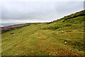

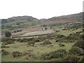
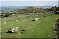
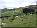
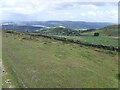
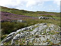
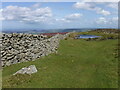
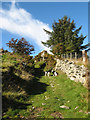
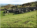
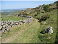
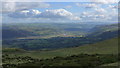
25 photos from this area
Area Information
Key information about the LL32 8LJ including its size, population, and administrative classification.
- Area Type
- Postcode
- Area Size
- 3.8 km²
- Population
- 1944
- Population Density
- 26 people/km²
House Prices in LL32 8LJ
11
Properties
£300,000
Average Sold Price
£300,000
Lowest Price
£300,000
Highest Price
Showing 11 properties
| Address | Type | Beds | Baths | Last Sale Price | Last Sale Date | |
|---|---|---|---|---|---|---|
| Ty'n Y Ffridd, Ffordd Hafodty, Llechwedd, Conwy, LL32 8LJ | Detached | - | - | £300,000 | Jan 2021 | |
| Bwlch Y Gydrhos Farm, Ffordd Hafodty, Llechwedd, Conwy, LL32 8LJ | house | 4 | - | - | - | |
| Garnedd Wen, Ffordd Hafodty, Llechwedd, Conwy, LL32 8LJ | Detached | 3 | - | - | - | |
| Ty'n Lon, Ffordd Hafodty, Llechwedd, Conwy, LL32 8LJ | Land | - | - | - | - | |
| Tyn Y Ffridd Isaf, Ffordd Hafodty, Llechwedd, Conwy, LL32 8LJ | Detached | - | - | - | - | |
| Cae Defeitty, Ffordd Hafodty, Llechwedd, Conwy, LL32 8LJ | Detached | - | - | - | - | |
| Pont Y Weirglodd, Ffordd Hafodty, Llechwedd, Conwy, LL32 8LJ | Detached | - | - | - | - | |
| Fferm Cae Defaidty, Ffordd Hafodty, Llechwedd, Conwy, LL32 8LJ | Detached | - | - | - | - | |
| Llannerch Y Fuwch, Ffordd Hafodty, Llechwedd, Conwy, LL32 8LJ | Detached | - | - | - | - | |
| Tyn Y Ffridd Bach, Ffordd Hafodty, Llechwedd, Conwy, LL32 8LJ | house | - | - | - | - |
Page 1 of 2
Energy Efficiency in LL32 8LJ
Amenities
Schools
| Rank | School | Type | Entry gender | Ages |
|---|
Explore more schools in this area
Go to Schools tabDemographics
Household Size
Two person
most common
Accommodation Type
Houses
most common
Tenure
79
majority
Ethnic Group
White
most common
Religion
N/A
most common
Household Composition
N/A
most common
Age
47
median
Adults (30-64 years)
most common
Household Deprivation
N/A
with no deprivation
NS-SEC
38
in Lower managerial occupations
Explore more demographic insights in this area
Go to Demographics tabPlanning
Planning Constraints
- Flood RiskPremium
- Ramsar Wetland SitesPremium
- Area of Outstanding Natural BeautyPremium
- Protected Nature ReservePremium
- Protected WoodlandPremium
- Crime RiskPremium