Area Overview for LL31 9UF
Photos of LL31 9UF
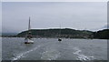
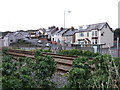
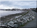
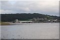
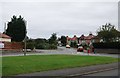
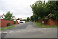
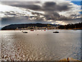
100 photos from this area
Area Information
Key information about the LL31 9UF including its size, population, and administrative classification.
- Area Type
- Postcode
- Area Size
- 7649 m²
- Population
- 1770
- Population Density
- 1804 people/km²
House Prices in LL31 9UF
26
Properties
£125,750
Average Sold Price
£100,000
Lowest Price
£170,000
Highest Price
Showing 26 properties
| Address | Type | Beds | Baths | Last Sale Price | Last Sale Date | |
|---|---|---|---|---|---|---|
| 31 Plas Newydd, Deganwy, LL31 9UF | house | - | - | £170,000 | Dec 2021 | |
| 16 Plas Newydd, Deganwy, LL31 9UF | Semi-detached | 3 | 1 | £159,995 | May 2021 | |
| 18 Plas Newydd, Deganwy, LL31 9UF | house | 4 | - | £120,000 | Feb 2018 | |
| 20 Plas Newydd, Deganwy, Conwy, LL31 9UF | house | 3 | 1 | £126,000 | Feb 2018 | |
| 19 Plas Newydd, Deganwy, LL31 9UF | house | - | - | £100,000 | Jan 2017 | |
| 25 Plas Newydd, Deganwy, LL31 9UF | Terraced | 3 | - | £115,000 | May 2015 | |
| 21 Plas Newydd, Deganwy, LL31 9UF | house | - | - | £120,000 | Feb 2010 | |
| 9 Plas Newydd, Deganwy, LL31 9UF | house | - | - | £124,000 | May 2007 | |
| 24 Plas Newydd, Deganwy, LL31 9UF | Terraced | - | - | £120,000 | Aug 2006 | |
| 4 Plas Newydd, Deganwy, LL31 9UF | Terraced | - | - | £102,500 | Jun 2005 |
Page 1 of 3
Energy Efficiency in LL31 9UF
Amenities
Schools
| Rank | School | Type | Entry gender | Ages |
|---|
Explore more schools in this area
Go to Schools tabDemographics
Household Size
One person
most common
Accommodation Type
Houses
most common
Tenure
71
majority
Ethnic Group
White
most common
Religion
N/A
most common
Household Composition
N/A
most common
Age
47
median
Adults (30-64 years)
most common
Household Deprivation
N/A
with no deprivation
NS-SEC
36
in Lower managerial occupations
Explore more demographic insights in this area
Go to Demographics tabPlanning
Planning Constraints
- Flood RiskPremium
- Ramsar Wetland SitesPremium
- Area of Outstanding Natural BeautyPremium
- Protected Nature ReservePremium
- Protected WoodlandPremium
- Crime RiskPremium