Area Overview for LL30 1LB
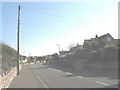
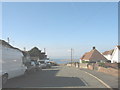
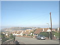
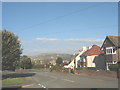
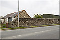
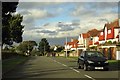
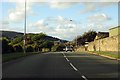
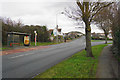
Photos of LL30 1LB
Area Information
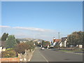
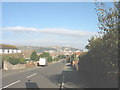
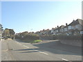
LL30 1LB is a small, tightly knit residential area in Wales, spanning just 6.9 hectares and home to 1,513 residents. Its compact size means it’s a quiet, localised cluster rather than a sprawling suburb, with a high population density of 22,078 people per square kilometre. The area is dominated by houses, reflecting its traditional residential character. Most residents are adults aged 30–64, with a median age of 47, suggesting a mature, stable community. While the area lacks major urban infrastructure, its proximity to Llandudno and surrounding towns offers access to broader amenities. Daily life here is likely to revolve around nearby shops, rail links, and the natural landscape, with a strong emphasis on local connectivity. The absence of protected environmental areas or planning constraints means development is unlikely to disrupt the area’s existing layout. For buyers, LL30 1LB presents a chance to own a home in a densely populated yet manageable setting, though the low home ownership rate (27%) indicates a rental market bias.
- Area Type
- Postcode
- Area Size
- 6.9 hectares
- Population
- 1513
- Population Density
- 1599 people/km²
LL30 1LB is a housing market where only 27% of residents own their homes, indicating a strong rental presence. The area is dominated by houses, with no flats or apartments listed in the data, suggesting a traditional, family-oriented housing stock. This mix of low home ownership and single-family homes may appeal to buyers seeking a long-term investment in a stable, residential environment. However, the small area size—just 6.9 hectares—means the housing stock is limited, and buyers should consider proximity to surrounding areas for more options. The lack of newer developments or high-density housing implies a conservative market, with property values likely influenced by local amenities and transport links. For those prioritising ownership, the area’s compact nature may require looking beyond LL30 1LB itself for larger selections.
House Prices in LL30 1LB
Showing 1 properties
| Address | Type | Beds | Baths | Last Sale Price | Last Sale Date | |
|---|---|---|---|---|---|---|
| Staff Quarters, Llandudno General Hospital, Hospital Road, Llandudno, LL30 1LB | commercial | - | - | - | - |
Energy Efficiency in LL30 1LB
LL30 1LB offers a mix of retail and transport amenities within practical reach. Five retail outlets, including Asda Llandudno, Aldi Llandudno, and Iceland Llandudno, provide everyday shopping options, while rail and metro stations like Llandudno Railway Station and Victoria Station ensure easy access to broader networks. Though the area lacks parks or leisure facilities in the data, its proximity to Llandudno and surrounding towns likely offers recreational opportunities. The presence of multiple transport hubs and local shops suggests a convenient, self-contained lifestyle, ideal for those prioritising accessibility over sprawling amenities. The compact nature of the area means residents can reach essential services quickly, blending practicality with a small-community feel.
Amenities
Schools
The nearest school to LL30 1LB is Ysgol Morfa Rhiannedd, categorised as an ‘other’ school type. No Ofsted rating is provided in the data, so its educational quality remains unspecified. Families relying on this school should investigate its curriculum and performance independently. The absence of additional schools in the data suggests limited options for local education, which could be a consideration for households with children. The single school listed may indicate a reliance on nearby towns like Llandudno for broader educational choices. For parents, this means planning for potential commutes or exploring other schools in adjacent areas. The mix of school types here is minimal, but the presence of one institution provides a baseline for family needs.
| Rank | School | Type | Entry gender | Ages |
|---|
Explore more schools in this area
Go to Schools tabDemographics
The population of LL30 1LB is predominantly composed of adults aged 30–64, with a median age of 47. This suggests a community of middle-aged residents, likely settled in long-term housing. Home ownership is low at 27%, meaning most residents are likely to be renters, which could influence the local property market dynamics. The area is characterised by houses rather than flats or apartments, reflecting its traditional housing stock. The predominant ethnic group is White, with no specific data on other demographics provided. The high population density—22,078 people per square kilometre—indicates a compact, possibly multi-generational living environment. While no deprivation data is available, the demographic profile suggests a stable, working-age population with limited reliance on social housing. This could imply a focus on private rental or long-term tenancy options.
Household Size
Accommodation Type
Tenure
Ethnic Group
Religion
Household Composition
Age
Household Deprivation
NS-SEC
Explore more demographic insights in this area
Go to Demographics tabPlanning
Planning Constraints
- Flood RiskPremium
- Ramsar Wetland SitesPremium
- Area of Outstanding Natural BeautyPremium
- Protected Nature ReservePremium
- Protected WoodlandPremium
- Crime RiskPremium