Area Overview for LL29 9ED
Photos of LL29 9ED

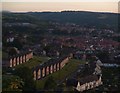
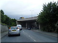
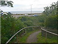
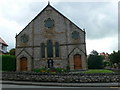
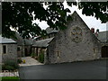
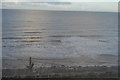

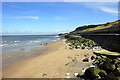

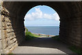
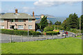
77 photos from this area
Area Information
Key information about the LL29 9ED including its size, population, and administrative classification.
- Area Type
- Postcode
- Area Size
- 6.5 hectares
- Population
- 1503
- Population Density
- 4031 people/km²
House Prices in LL29 9ED
29
Properties
£117,854
Average Sold Price
£36,500
Lowest Price
£175,750
Highest Price
Showing 29 properties
| Address | Type | Beds | Baths | Last Sale Price | Last Sale Date | |
|---|---|---|---|---|---|---|
| 11 Queens Way, Old Colwyn, Colwyn Bay, LL29 9ED | Terraced | 2 | 1 | £120,000 | Dec 2023 | |
| 23 Queens Way, Old Colwyn, Colwyn Bay, LL29 9ED | Semi-detached | 2 | 1 | £147,500 | Nov 2023 | |
| 29 Queens Way, Old Colwyn, Colwyn Bay, LL29 9ED | Semi-detached | 3 | 1 | £143,000 | Aug 2023 | |
| 22 Queens Way, Old Colwyn, Colwyn Bay, LL29 9ED | Retail | 3 | 1 | £175,750 | Sep 2022 | |
| Sea Cottage, 27 Queens Way, Old Colwyn, Colwyn Bay, LL29 9ED | house | - | - | £160,000 | Dec 2021 | |
| 12 Queens Way, Old Colwyn, Colwyn Bay, LL29 9ED | Terraced | 2 | - | £122,000 | Apr 2015 | |
| 4 Queens Way, Old Colwyn, Colwyn Bay, LL29 9ED | Semi-detached | 2 | - | £105,000 | Feb 2015 | |
| 1 Queens Way, Old Colwyn, Colwyn Bay, LL29 9ED | house | - | - | £115,000 | Aug 2014 | |
| 3 Queens Way, Old Colwyn, Colwyn Bay, LL29 9ED | Semi-detached | 3 | 2 | £122,000 | Apr 2012 | |
| 2 Queens Way, Old Colwyn, Colwyn Bay, LL29 9ED | house | - | - | £125,000 | Jan 2012 |
Page 1 of 3
Energy Efficiency in LL29 9ED
Amenities
Schools
| Rank | School | Type | Entry gender | Ages |
|---|
Explore more schools in this area
Go to Schools tabDemographics
Household Size
One person
most common
Accommodation Type
Houses
most common
Tenure
69
majority
Ethnic Group
White
most common
Religion
N/A
most common
Household Composition
N/A
most common
Age
47
median
Adults (30-64 years)
most common
Household Deprivation
N/A
with no deprivation
NS-SEC
31
in Lower managerial occupations
Explore more demographic insights in this area
Go to Demographics tabPlanning
Planning Constraints
- Flood RiskPremium
- Ramsar Wetland SitesPremium
- Area of Outstanding Natural BeautyPremium
- Protected Nature ReservePremium
- Protected WoodlandPremium
- Crime RiskPremium