Area Overview for LL29 9DR
Photos of LL29 9DR

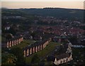

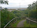


77 photos from this area
Area Information
Key information about the LL29 9DR including its size, population, and administrative classification.
- Area Type
- Postcode
- Area Size
- 8436 m²
- Population
- 1503
- Population Density
- 4031 people/km²
House Prices in LL29 9DR
22
Properties
£180,727
Average Sold Price
£57,000
Lowest Price
£325,000
Highest Price
Showing 22 properties
| Address | Type | Beds | Baths | Last Sale Price | Last Sale Date | |
|---|---|---|---|---|---|---|
| 30 Heenan Road, Old Colwyn, Colwyn Bay, LL29 9DR | Semi-detached | 4 | 2 | £325,000 | Mar 2025 | |
| 20 Heenan Road, Old Colwyn, Colwyn Bay, LL29 9DR | Flat | - | - | £120,050 | Jul 2023 | |
| 22 Heenan Road, Old Colwyn, Colwyn Bay, LL29 9DR | Flat | 2 | 1 | £95,000 | Jul 2023 | |
| 18 Heenan Road, Old Colwyn, Colwyn Bay, LL29 9DR | Retail | 4 | 1 | £305,000 | Sep 2022 | |
| 4 Heenan Road, Old Colwyn, Colwyn Bay, LL29 9DR | house | 4 | - | £318,000 | Jan 2020 | |
| 40 Heenan Road, Old Colwyn, Colwyn Bay, LL29 9DR | Semi-detached | 3 | - | £229,950 | Nov 2019 | |
| 34 Heenan Road, Old Colwyn, Colwyn Bay, LL29 9DR | house | - | - | £165,000 | Aug 2014 | |
| 6 Heenan Road, Old Colwyn, Colwyn Bay, LL29 9DR | house | - | - | £190,000 | Jan 2013 | |
| 16 Heenan Road, Old Colwyn, Colwyn Bay, LL29 9DR | Semi-detached | 4 | 1 | £132,500 | Nov 2008 | |
| 26 Heenan Road, Old Colwyn, Colwyn Bay, LL29 9DR | Semi-detached | - | - | £174,950 | May 2006 |
Page 1 of 3
Energy Efficiency in LL29 9DR
Amenities
Schools
| Rank | School | Type | Entry gender | Ages |
|---|
Explore more schools in this area
Go to Schools tabDemographics
Household Size
One person
most common
Accommodation Type
Houses
most common
Tenure
69
majority
Ethnic Group
White
most common
Religion
N/A
most common
Household Composition
N/A
most common
Age
47
median
Adults (30-64 years)
most common
Household Deprivation
N/A
with no deprivation
NS-SEC
31
in Lower managerial occupations
Explore more demographic insights in this area
Go to Demographics tabPlanning
Planning Constraints
- Flood RiskPremium
- Ramsar Wetland SitesPremium
- Area of Outstanding Natural BeautyPremium
- Protected Nature ReservePremium
- Protected WoodlandPremium
- Crime RiskPremium