Area Overview for LL29 7NW
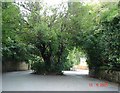
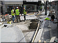
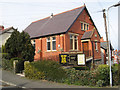
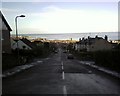
Photos of LL29 7NW


Area Information
LL29 7NW is a small residential cluster in Wales, home to 2077 residents. It is a compact area where daily life is shaped by its proximity to local amenities and transport links. The community here is predominantly composed of adults aged 30–64, with a median age of 47, suggesting a mature, established population. This postcode area is not defined by sprawling suburbs but by a focused residential layout, offering a quiet, community-oriented environment. Residents benefit from nearby retail options, rail stations, and metro stops, ensuring practical access to services and connectivity. While the area is small, it is positioned to serve as a base for those seeking a balance between local convenience and regional accessibility. The absence of major environmental constraints or flood risks adds to its appeal, though the lack of detailed crime data for Wales means safety assessments remain partial. For those considering living here, the mix of flats and the moderate home ownership rate indicate a blend of owner-occupied and rental properties, reflecting a pragmatic housing market.
- Area Type
- Postcode
- Area Size
- Not available
- Population
- 2077
- Population Density
- 3923 people/km²
LL29 7NW’s property market is characterised by a 42% home ownership rate, with flats being the predominant accommodation type. This indicates a market skewed towards rental properties, with a significant portion of the housing stock likely managed by landlords or housing associations. The prevalence of flats suggests smaller, more compact living spaces, which may appeal to those seeking affordability or ease of maintenance. Given the area’s small size, the housing stock is limited, meaning buyers should consider the immediate surroundings for more options. The moderate home ownership rate also implies that the area is not dominated by long-term residents, potentially offering opportunities for new buyers to enter the market. However, the lack of detailed data on property prices or trends means that the financial dynamics of the local market remain unclear. For those interested in purchasing, the focus should be on the availability of flats and the practicality of the area’s size for long-term living.
House Prices in LL29 7NW
No properties found in this postcode.
Energy Efficiency in LL29 7NW
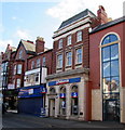
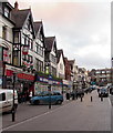
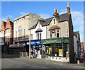
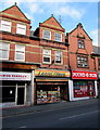
Living in LL29 7NW offers access to a range of practical amenities within reach. Retail options include Morrisons Llandrillo-yn, Heron Colwyn, and Lidl Llandrillo-yn, providing everyday shopping needs. These stores cater to local demand, ensuring residents can access groceries and household essentials without long journeys. The area’s rail and metro stations—such as Colwyn Bay and Victoria—connect to broader networks, enabling travel to nearby towns for more specialised services. While the data does not mention parks or leisure facilities, the presence of multiple transport hubs suggests that residents can easily access recreational areas in surrounding regions. The combination of retail, transport, and proximity to other amenities creates a lifestyle that balances local convenience with regional opportunities. This makes LL29 7NW suitable for those who value practicality and accessibility in their daily routines.
Amenities
Schools
The nearest school to LL29 7NW is St Joseph’s R.C. Primary School, which serves the local community. While no Ofsted rating is provided, the presence of a primary school indicates that families with young children have access to essential educational infrastructure. The absence of secondary schools or other educational institutions in the data means that residents may need to travel to nearby areas for higher education. This suggests that the area is better suited for families with younger children, though those requiring secondary schooling may need to look beyond LL29 7NW. The single school listed reflects a basic educational offering, and the lack of diversity in school types means that parents may have limited options for different educational approaches. However, the proximity of rail stations could ease commutes to larger towns with more comprehensive schools.
| Rank | School | Type | Entry gender | Ages |
|---|
Explore more schools in this area
Go to Schools tabDemographics
The population of LL29 7NW is predominantly adults aged 30–64, with a median age of 47. This suggests a community of middle-aged individuals, likely established in their careers and family lives. Home ownership stands at 42%, indicating that nearly half of residents own their homes, while the remaining 58% may be renters or in other housing arrangements. The accommodation type is primarily flats, which aligns with the area’s compact nature and suggests a focus on smaller, managed housing units. The predominant ethnic group is White, though no further breakdown of diversity is provided. The absence of specific data on deprivation means that quality of life factors such as access to services or economic hardship cannot be quantified here. However, the presence of nearby schools, retail, and transport infrastructure implies that essential needs are met. The age profile and housing stock suggest a stable, low-turnover community, with residents likely prioritising proximity to amenities over larger living spaces.
Household Size
Accommodation Type
Tenure
Ethnic Group
Religion
Household Composition
Age
Household Deprivation
NS-SEC
Explore more demographic insights in this area
Go to Demographics tabPlanning
Planning Constraints
- Flood RiskPremium
- Ramsar Wetland SitesPremium
- Area of Outstanding Natural BeautyPremium
- Protected Nature ReservePremium
- Protected WoodlandPremium
- Crime RiskPremium