Area Overview for LL29 7AH
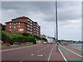
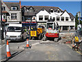
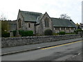
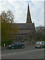
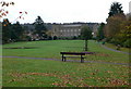
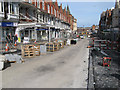
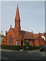
Photos of LL29 7AH


Area Information
Living in LL29 7AH means being part of a small, tightly knit residential cluster in Wales, home to 2077 people. This postcode area is characterised by its compact nature, with a focus on practical living for those prioritising convenience over sprawling landscapes. The community here is predominantly middle-aged, with a median age of 47 and the majority of residents falling within the 30-64 age range. Daily life is shaped by proximity to essential services, including retail outlets and public transport hubs. While the area lacks large-scale amenities, its accessibility to nearby towns and cities via rail and metro links ensures residents are well-connected. The presence of flats as the primary accommodation type suggests a mix of owner-occupied and rental properties, reflecting a balance between long-term residents and those seeking temporary housing. LL29 7AH is not a place for those seeking luxury or grandeur, but it offers a straightforward, no-frills lifestyle suited to those valuing simplicity and functional living.
- Area Type
- Postcode
- Area Size
- Not available
- Population
- 2077
- Population Density
- 3923 people/km²
The property market in LL29 7AH is dominated by flats, with no indication of larger detached homes or family-oriented housing stock. This suggests a focus on compact, efficient living spaces, likely catering to renters or those seeking short-term accommodation. With 42% of residents owning their homes, the area is not a strong market for buyers seeking long-term investment, as the majority of housing is occupied by tenants. The concentration of flats may also imply limited scope for property development or expansion, which could affect future value growth. For buyers, this means the area is more suited to those prioritising rental availability over ownership, though the small size of the postcode may limit options for those seeking larger or more varied housing types. The practicality of the housing stock aligns with the area’s compact nature, making it a viable choice for those seeking affordability and proximity to services.
House Prices in LL29 7AH
No properties found in this postcode.
Energy Efficiency in LL29 7AH
The lifestyle in LL29 7AH is shaped by its proximity to practical amenities, including retail outlets like Morrisons, Heron Colwyn, and Lidl, which cater to everyday shopping needs. The presence of rail and metro stations adds convenience for travel, whether for commuting or leisure. While the area lacks large parks or recreational spaces, its small size means residents can access nearby towns for broader leisure options. The community’s character is defined by its simplicity and functionality, with no grandiose facilities but a focus on accessibility. For those valuing convenience over luxury, the mix of shops, transport links, and digital connectivity provides a straightforward, no-nonsense lifestyle. The area’s limitations in size and amenities are balanced by its practicality, making it suitable for those prioritising ease of access to services over expansive recreational opportunities.
Amenities
Schools
The only named school near LL29 7AH is St Joseph’s R.C. Primary School, which serves the local community with primary education. While no Ofsted rating is provided, its presence indicates that families with young children have access to a religiously affiliated educational institution. The absence of secondary schools or additional educational facilities within the area means residents may need to travel to nearby towns for higher education. This limitation could be a consideration for families planning long-term stays, as the school options are restricted to primary level. However, the existence of a single school suggests a modest but functional approach to education in the area, catering to local needs without overextending resources.
| Rank | School | Type | Entry gender | Ages |
|---|
Explore more schools in this area
Go to Schools tabDemographics
The demographic profile of LL29 7AH is defined by its mature population, with a median age of 47 and the largest age group being adults aged 30-64. This suggests a community of established professionals, families, or retirees, with limited presence of younger or older demographics. Home ownership stands at 42%, indicating that nearly half of residents rent their homes, which may reflect the area’s focus on flats as the predominant accommodation type. The majority of the population identifies as White, with no data provided on other ethnic groups. The relatively small population of 2077 fosters a close-knit environment, though it also limits the diversity of household structures and age ranges. For those considering life here, the data highlights a stable, middle-aged demographic with a clear preference for rental housing, which may influence local property dynamics and community interactions.
Household Size
Accommodation Type
Tenure
Ethnic Group
Religion
Household Composition
Age
Household Deprivation
NS-SEC
Explore more demographic insights in this area
Go to Demographics tabPlanning
Planning Constraints
- Flood RiskPremium
- Ramsar Wetland SitesPremium
- Area of Outstanding Natural BeautyPremium
- Protected Nature ReservePremium
- Protected WoodlandPremium
- Crime RiskPremium