Area Overview for LL29 6DT
Photos of LL29 6DT
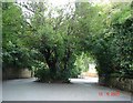


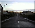

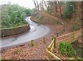
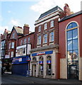
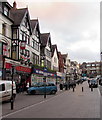
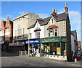
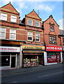

94 photos from this area
Area Information
Key information about the LL29 6DT including its size, population, and administrative classification.
- Area Type
- Postcode
- Area Size
- 8625 m²
- Population
- 1497
- Population Density
- 486 people/km²
House Prices in LL29 6DT
20
Properties
£157,263
Average Sold Price
£59,950
Lowest Price
£285,000
Highest Price
Showing 20 properties
| Address | Type | Beds | Baths | Last Sale Price | Last Sale Date | |
|---|---|---|---|---|---|---|
| 16 Bryn Garan, Upper Colwyn Bay, Colwyn Bay, LL29 6DT | Detached | 3 | 1 | £280,000 | Aug 2025 | |
| 26 Bryn Garan, Upper Colwyn Bay, Colwyn Bay, LL29 6DT | Bungalow | 2 | 1 | £285,000 | Sep 2024 | |
| 4 Bryn Garan, Upper Colwyn Bay, Colwyn Bay, LL29 6DT | Semi-detached | 4 | 1 | £275,000 | Aug 2023 | |
| 7 Bryn Garan, Upper Colwyn Bay, Colwyn Bay, LL29 6DT | Bungalow | 2 | 1 | £185,000 | Mar 2021 | |
| 10 Bryn Garan, Upper Colwyn Bay, Colwyn Bay, LL29 6DT | house | 4 | - | £245,000 | Jan 2021 | |
| 3 Bryn Garan, Upper Colwyn Bay, Colwyn Bay, LL29 6DT | Semi-detached | 3 | 1 | £155,000 | Jul 2020 | |
| 20 Bryn Garan, Upper Colwyn Bay, Colwyn Bay, LL29 6DT | house | - | - | £226,000 | Sep 2016 | |
| 18 Bryn Garan, Upper Colwyn Bay, Colwyn Bay, LL29 6DT | Detached | 4 | - | £218,750 | Oct 2015 | |
| 1 Bryn Garan, Upper Colwyn Bay, Colwyn Bay, LL29 6DT | house | - | - | £142,000 | Sep 2014 | |
| 5 Bryn Garan, Upper Colwyn Bay, Colwyn Bay, LL29 6DT | Bungalow | 2 | 1 | £180,000 | May 2014 |
Page 1 of 2
Energy Efficiency in LL29 6DT
Amenities
Schools
| Rank | School | Type | Entry gender | Ages |
|---|
Explore more schools in this area
Go to Schools tabDemographics
Household Size
Two person
most common
Accommodation Type
Houses
most common
Tenure
90
majority
Ethnic Group
White
most common
Religion
N/A
most common
Household Composition
N/A
most common
Age
47
median
Adults (30-64 years)
most common
Household Deprivation
N/A
with no deprivation
NS-SEC
49
in Lower managerial occupations
Explore more demographic insights in this area
Go to Demographics tabPlanning
Planning Constraints
- Flood RiskPremium
- Ramsar Wetland SitesPremium
- Area of Outstanding Natural BeautyPremium
- Protected Nature ReservePremium
- Protected WoodlandPremium
- Crime RiskPremium