Area Overview for LL28 4UU
Photos of LL28 4UU
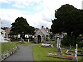
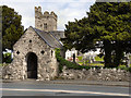


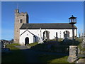
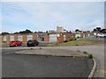
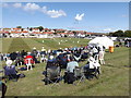
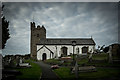
100 photos from this area
Area Information
Key information about the LL28 4UU including its size, population, and administrative classification.
- Area Type
- Postcode
- Area Size
- 3.0 hectares
- Population
- 1411
- Population Density
- 1327 people/km²
House Prices in LL28 4UU
16
Properties
£178,722
Average Sold Price
£46,500
Lowest Price
£286,000
Highest Price
Showing 16 properties
| Address | Type | Beds | Baths | Last Sale Price | Last Sale Date | |
|---|---|---|---|---|---|---|
| 17 Aled Drive, Rhos On Sea, LL28 4UU | Bungalow | 2 | 1 | £285,000 | Dec 2024 | |
| 5 Aled Drive, Rhos On Sea, LL28 4UU | Bungalow | 2 | 1 | £286,000 | Aug 2022 | |
| 11 Aled Drive, Rhos On Sea, LL28 4UU | Bungalow | - | - | £193,000 | Jan 2020 | |
| 10 Aled Drive, Rhos On Sea, LL28 4UU | Bungalow | - | - | £172,664 | Jun 2017 | |
| 4 Aled Drive, Rhos On Sea, LL28 4UU | Bungalow | 2 | - | £177,500 | Nov 2015 | |
| 7 Aled Drive, Rhos On Sea, LL28 4UU | Bungalow | - | - | £160,000 | Aug 2013 | |
| 8 Aled Drive, Rhos On Sea, LL28 4UU | Bungalow | - | - | £167,500 | Feb 2010 | |
| 3 Aled Drive, Rhos On Sea, LL28 4UU | Bungalow | - | - | £162,000 | Jun 2009 | |
| 15 Aled Drive, Rhos On Sea, LL28 4UU | Detached | - | - | £237,500 | Oct 2004 | |
| 16 Aled Drive, Rhos On Sea, LL28 4UU | Detached | - | - | £199,000 | Jul 2004 |
Page 1 of 2
Energy Efficiency in LL28 4UU
Amenities
Schools
| Rank | School | Type | Entry gender | Ages |
|---|
Explore more schools in this area
Go to Schools tabDemographics
Household Size
Two person
most common
Accommodation Type
Houses
most common
Tenure
84
majority
Ethnic Group
White
most common
Religion
N/A
most common
Household Composition
N/A
most common
Age
47
median
Adults (30-64 years)
most common
Household Deprivation
N/A
with no deprivation
NS-SEC
34
in Lower managerial occupations
Explore more demographic insights in this area
Go to Demographics tabPlanning
Planning Constraints
- Flood RiskPremium
- Ramsar Wetland SitesPremium
- Area of Outstanding Natural BeautyPremium
- Protected Nature ReservePremium
- Protected WoodlandPremium
- Crime RiskPremium