Area Overview for LL28 4TN
Photos of LL28 4TN
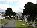
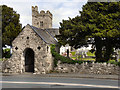


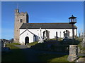
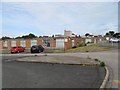

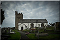
100 photos from this area
Area Information
Key information about the LL28 4TN including its size, population, and administrative classification.
- Area Type
- Postcode
- Area Size
- 1.3 hectares
- Population
- 1560
- Population Density
- 1864 people/km²
House Prices in LL28 4TN
16
Properties
£305,531
Average Sold Price
£95,000
Lowest Price
£523,000
Highest Price
Showing 16 properties
| Address | Type | Beds | Baths | Last Sale Price | Last Sale Date | |
|---|---|---|---|---|---|---|
| 2 Brompton Park, Rhos On Sea, LL28 4TN | Detached | 3 | 2 | £460,000 | Jun 2025 | |
| 3 Brompton Park, Rhos On Sea, LL28 4TN | Bungalow | 2 | 2 | £370,000 | Jun 2025 | |
| 19 Brompton Park, Rhos On Sea, LL28 4TN | Bungalow | 2 | 1 | £297,000 | Jan 2025 | |
| 9 Brompton Park, Rhos On Sea, LL28 4TN | Bungalow | 2 | 2 | £337,500 | Oct 2024 | |
| 10 Brompton Park, Rhos On Sea, LL28 4TN | Detached | 3 | 2 | £395,000 | Mar 2024 | |
| 6 Brompton Park, Rhos On Sea, LL28 4TN | Detached | 4 | 2 | £523,000 | Mar 2023 | |
| 21 Brompton Park, Rhos On Sea, LL28 4TN | Bungalow | - | - | £290,000 | Feb 2019 | |
| 15 Brompton Park, Rhos On Sea, LL28 4TN | Bungalow | - | - | £322,500 | Oct 2018 | |
| 11 Brompton Park, Rhos On Sea, LL28 4TN | Bungalow | - | - | £265,000 | Feb 2017 | |
| 5 Brompton Park, Rhos On Sea, LL28 4TN | Detached | 3 | 2 | £230,000 | Mar 2015 |
Page 1 of 2
Energy Efficiency in LL28 4TN
Amenities
Schools
| Rank | School | Type | Entry gender | Ages |
|---|
Explore more schools in this area
Go to Schools tabDemographics
Household Size
Two person
most common
Accommodation Type
Houses
most common
Tenure
79
majority
Ethnic Group
White
most common
Religion
N/A
most common
Household Composition
N/A
most common
Age
47
median
Elderly (65+ years)
most common
Household Deprivation
N/A
with no deprivation
NS-SEC
38
in Lower managerial occupations
Explore more demographic insights in this area
Go to Demographics tabPlanning
Planning Constraints
- Flood RiskPremium
- Ramsar Wetland SitesPremium
- Area of Outstanding Natural BeautyPremium
- Protected Nature ReservePremium
- Protected WoodlandPremium
- Crime RiskPremium