Area Overview for LL28 4PN
Photos of LL28 4PN
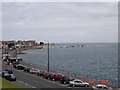

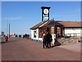
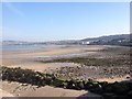
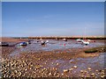
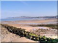
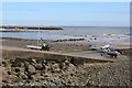

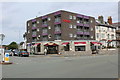

99 photos from this area
Area Information
Key information about the LL28 4PN including its size, population, and administrative classification.
- Area Type
- Postcode
- Area Size
- 2987 m²
- Population
- 1486
- Population Density
- 3882 people/km²
House Prices in LL28 4PN
51
Properties
£108,169
Average Sold Price
£74,500
Lowest Price
£161,500
Highest Price
Showing 51 properties
| Address | Type | Beds | Baths | Last Sale Price | Last Sale Date | |
|---|---|---|---|---|---|---|
| 49, Rhos Manor, Penrhyn Avenue, Rhos On Sea, LL28 4PN | Flat | 1 | 1 | £95,000 | Jul 2025 | |
| 31, Rhos Manor, Penrhyn Avenue, Rhos On Sea, LL28 4PN | Flat | 1 | 1 | £105,000 | Sep 2024 | |
| 36, Rhos Manor, Penrhyn Avenue, Rhos On Sea, LL28 4PN | Flat | 1 | 1 | £92,500 | Nov 2023 | |
| 28, Rhos Manor, Penrhyn Avenue, Rhos On Sea, LL28 4PN | Flat | - | - | £99,950 | Jan 2023 | |
| 39, Rhos Manor, Penrhyn Avenue, Rhos On Sea, LL28 4PN | Flat | 1 | 1 | £88,000 | Jan 2023 | |
| 42, Rhos Manor, Penrhyn Avenue, Rhos On Sea, LL28 4PN | Flat | - | - | £150,000 | Dec 2022 | |
| 29, Rhos Manor, Penrhyn Avenue, Rhos On Sea, LL28 4PN | Flat | - | - | £80,000 | Mar 2022 | |
| 48, Rhos Manor, Penrhyn Avenue, Rhos On Sea, LL28 4PN | Flat | - | - | £96,000 | Dec 2021 | |
| 34, Rhos Manor, Penrhyn Avenue, Rhos On Sea, LL28 4PN | Flat | - | - | £134,000 | Mar 2021 | |
| 40, Rhos Manor, Penrhyn Avenue, Rhos On Sea, LL28 4PN | Flat | - | - | £118,000 | Dec 2020 |
Page 1 of 6
Energy Efficiency in LL28 4PN
Amenities
Schools
| Rank | School | Type | Entry gender | Ages |
|---|
Explore more schools in this area
Go to Schools tabDemographics
Household Size
One person
most common
Accommodation Type
Flats
most common
Tenure
68
majority
Ethnic Group
White
most common
Religion
N/A
most common
Household Composition
N/A
most common
Age
47
median
Elderly (65+ years)
most common
Household Deprivation
N/A
with no deprivation
NS-SEC
35
in Lower managerial occupations
Explore more demographic insights in this area
Go to Demographics tabPlanning
Planning Constraints
- Flood RiskPremium
- Ramsar Wetland SitesPremium
- Area of Outstanding Natural BeautyPremium
- Protected Nature ReservePremium
- Protected WoodlandPremium
- Crime RiskPremium