Area Overview for LL28 4HG
Photos of LL28 4HG
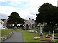
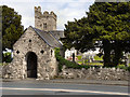


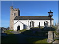
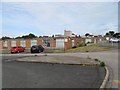

100 photos from this area
Area Information
Key information about the LL28 4HG including its size, population, and administrative classification.
- Area Type
- Postcode
- Area Size
- 9708 m²
- Population
- 1409
- Population Density
- 3081 people/km²
House Prices in LL28 4HG
13
Properties
£197,606
Average Sold Price
£105,000
Lowest Price
£446,000
Highest Price
Showing 13 properties
| Address | Type | Beds | Baths | Last Sale Price | Last Sale Date | |
|---|---|---|---|---|---|---|
| 6 St Georges Road, Rhos On Sea, LL28 4HG | Flat | 2 | 1 | £189,000 | Jun 2025 | |
| 2A St Georges Road, Rhos On Sea, LL28 4HG | Flat | - | - | £167,000 | May 2024 | |
| Colwyn, St Georges Road, Rhos On Sea, LL28 4HG | Bungalow | 2 | 2 | £446,000 | Nov 2023 | |
| 6A St Georges Road, Rhos On Sea, LL28 4HG | Maisonette | - | - | £137,000 | Mar 2022 | |
| 4A St Georges Road, Rhos On Sea, LL28 4HG | Flat | - | - | £189,950 | Mar 2022 | |
| Cliffe Cottage, Whitehall Road, Rhos On Sea, LL28 4HG | Detached | 3 | - | £185,000 | Jan 2017 | |
| 4 St Georges Road, Rhos On Sea, LL28 4HG | Flat | - | - | £110,000 | Dec 2014 | |
| Taringa, St Georges Road, Rhos On Sea, LL28 4HG | Detached | - | - | £249,500 | Jun 2003 | |
| Borrowdale, St Georges Road, Rhos On Sea, LL28 4HG | Detached | 3 | 3 | £105,000 | Jun 1999 | |
| 2 St Georges Road, Rhos On Sea, LL28 4HG | Flat | - | - | - | - |
Page 1 of 2
Energy Efficiency in LL28 4HG
Amenities
Schools
| Rank | School | Type | Entry gender | Ages |
|---|
Explore more schools in this area
Go to Schools tabDemographics
Household Size
Two person
most common
Accommodation Type
Houses
most common
Tenure
72
majority
Ethnic Group
White
most common
Religion
N/A
most common
Household Composition
N/A
most common
Age
47
median
Adults (30-64 years)
most common
Household Deprivation
N/A
with no deprivation
NS-SEC
41
in Lower managerial occupations
Explore more demographic insights in this area
Go to Demographics tabPlanning
Planning Constraints
- Flood RiskPremium
- Ramsar Wetland SitesPremium
- Area of Outstanding Natural BeautyPremium
- Protected Nature ReservePremium
- Protected WoodlandPremium
- Crime RiskPremium