Area Overview for LL28 4AG
Photos of LL28 4AG
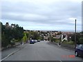
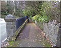
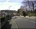
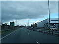

93 photos from this area
Area Information
Key information about the LL28 4AG including its size, population, and administrative classification.
- Area Type
- Postcode
- Area Size
- 5428 m²
- Population
- 1411
- Population Density
- 1327 people/km²
House Prices in LL28 4AG
5
Properties
£160,800
Average Sold Price
£75,000
Lowest Price
£239,000
Highest Price
Showing 5 properties
| Address | Type | Beds | Baths | Last Sale Price | Last Sale Date | |
|---|---|---|---|---|---|---|
| 3 Horton Drive, Rhos On Sea, LL28 4AG | Bungalow | 2 | 2 | £239,000 | Jun 2021 | |
| 1 Horton Drive, Rhos On Sea, LL28 4AG | Bungalow | 2 | 1 | £205,000 | Jul 2016 | |
| 15 HORTON DRIVE, Rhos on Sea, LL28 4AG | Semi-detached | - | - | £75,000 | Jan 2015 | |
| 5 Horton Drive, Rhos On Sea, LL28 4AG | Bungalow | - | - | £160,000 | Sep 2010 | |
| 11 Horton Drive, Rhos On Sea, LL28 4AG | Semi-detached | - | - | £125,000 | Sep 2004 |
Energy Efficiency in LL28 4AG
Amenities
Schools
| Rank | School | Type | Entry gender | Ages |
|---|
Explore more schools in this area
Go to Schools tabDemographics
Household Size
Two person
most common
Accommodation Type
Houses
most common
Tenure
84
majority
Ethnic Group
White
most common
Religion
N/A
most common
Household Composition
N/A
most common
Age
47
median
Adults (30-64 years)
most common
Household Deprivation
N/A
with no deprivation
NS-SEC
34
in Lower managerial occupations
Explore more demographic insights in this area
Go to Demographics tabPlanning
Planning Constraints
- Flood RiskPremium
- Ramsar Wetland SitesPremium
- Area of Outstanding Natural BeautyPremium
- Protected Nature ReservePremium
- Protected WoodlandPremium
- Crime RiskPremium