Area Overview for LL27 0JZ
Photos of LL27 0JZ
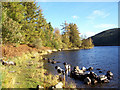
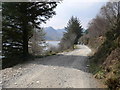
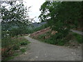
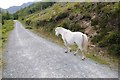
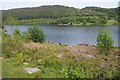
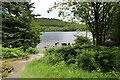
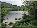
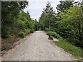
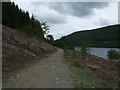
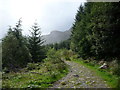
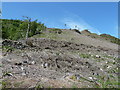
19 photos from this area
Area Information
Key information about the LL27 0JZ including its size, population, and administrative classification.
- Area Type
- Postcode
- Area Size
- 16.2 km²
- Population
- 1237
- Population Density
- 24 people/km²
House Prices in LL27 0JZ
35
Properties
£388,333
Average Sold Price
£40,000
Lowest Price
£900,000
Highest Price
Showing 35 properties
| Address | Type | Beds | Baths | Last Sale Price | Last Sale Date | |
|---|---|---|---|---|---|---|
| Winfield, Crafnant Road, Trefriw, LL27 0JZ | Detached | 6 | 5 | £900,000 | May 2025 | |
| Nant Y Rhedyn, Crafnant Road, Trefriw, LL27 0JZ | Detached | 5 | - | £820,000 | May 2024 | |
| Drws Y Nant, Crafnant Road, Trefriw, LL27 0JZ | Bungalow | 3 | - | £379,500 | Oct 2023 | |
| Gelli Lydan, Crafnant Road, Trefriw, LL27 0JZ | Bungalow | - | - | £200,000 | Sep 2022 | |
| Llanerch, Crafnant Road, Trefriw, LL27 0JZ | Bungalow | - | - | £435,000 | Apr 2021 | |
| Plas Engan, Crafnant Road, Trefriw, LL27 0JZ | Detached | 5 | 3 | £585,000 | Sep 2018 | |
| Plas Bach, Crafnant Road, Trefriw, LL27 0JZ | Detached | 4 | 1 | £405,000 | Aug 2017 | |
| COED CELYN, CRAFNANT ROAD, Trefriw, LL27 0JZ | Detached | - | - | £260,000 | Jan 2017 | |
| Hafod Arthen, Crafnant Road, Trefriw, LL27 0JZ | house | - | - | £228,500 | May 2012 | |
| Maes Y Coed, Crafnant Road, Trefriw, LL27 0JZ | house | - | - | £300,000 | Dec 2005 |
Page 1 of 4
Energy Efficiency in LL27 0JZ
Amenities
Schools
| Rank | School | Type | Entry gender | Ages |
|---|
Explore more schools in this area
Go to Schools tabDemographics
Household Size
Two person
most common
Accommodation Type
Houses
most common
Tenure
78
majority
Ethnic Group
White
most common
Religion
N/A
most common
Household Composition
N/A
most common
Age
47
median
Adults (30-64 years)
most common
Household Deprivation
N/A
with no deprivation
NS-SEC
27
in Lower managerial occupations
Explore more demographic insights in this area
Go to Demographics tabPlanning
Planning Constraints
- Flood RiskPremium
- Ramsar Wetland SitesPremium
- Area of Outstanding Natural BeautyPremium
- Protected Nature ReservePremium
- Protected WoodlandPremium
- Crime RiskPremium