Area Overview for LL26 0DH
Photos of LL26 0DH
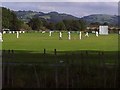


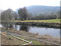
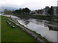

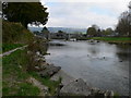


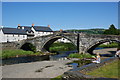
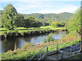
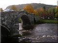
100 photos from this area
Area Information
Key information about the LL26 0DH including its size, population, and administrative classification.
- Area Type
- Postcode
- Area Size
- 1.3 hectares
- Population
- 1085
- Population Density
- 859 people/km²
House Prices in LL26 0DH
35
Properties
£114,195
Average Sold Price
£30,000
Lowest Price
£245,000
Highest Price
Showing 35 properties
| Address | Type | Beds | Baths | Last Sale Price | Last Sale Date | |
|---|---|---|---|---|---|---|
| Dedwyddfa, 6 Cae Llan, Llanrwst, LL26 0DH | house | 3 | 1 | £217,500 | Dec 2024 | |
| Penrhwylfa, 5 Cae Llan, Llanrwst, LL26 0DH | house | 4 | - | £245,000 | Oct 2024 | |
| 23 Cae Llan, Llanrwst, LL26 0DH | house | 3 | 1 | £145,000 | Dec 2023 | |
| 31 Cae Llan, Llanrwst, LL26 0DH | Terraced | 3 | 1 | £142,500 | Aug 2023 | |
| 29 Cae Llan, Llanrwst, LL26 0DH | house | - | - | £160,000 | Feb 2023 | |
| Gwynllys, 19 Cae Llan, Llanrwst, LL26 0DH | house | - | - | £212,000 | Sep 2021 | |
| 28 Cae Llan, Llanrwst, LL26 0DH | house | - | - | £130,000 | Jun 2021 | |
| 14 Cae Llan, Llanrwst, LL26 0DH | house | - | - | £140,000 | Jan 2019 | |
| Cartref, 15 Cae Llan, Llanrwst, LL26 0DH | house | - | - | £124,950 | Jul 2018 | |
| 20 Cae Llan, Llanrwst, LL26 0DH | house | 3 | 1 | £130,000 | May 2015 |
Page 1 of 4
Energy Efficiency in LL26 0DH
Amenities
Schools
| Rank | School | Type | Entry gender | Ages |
|---|
Explore more schools in this area
Go to Schools tabDemographics
Household Size
Family (3-5 people)
most common
Accommodation Type
Houses
most common
Tenure
66
majority
Ethnic Group
White
most common
Religion
N/A
most common
Household Composition
N/A
most common
Age
47
median
Adults (30-64 years)
most common
Household Deprivation
N/A
with no deprivation
NS-SEC
25
in Lower managerial occupations
Explore more demographic insights in this area
Go to Demographics tabPlanning
Planning Constraints
- Flood RiskPremium
- Ramsar Wetland SitesPremium
- Area of Outstanding Natural BeautyPremium
- Protected Nature ReservePremium
- Protected WoodlandPremium
- Crime RiskPremium