Area Overview for LL26 0AP
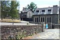
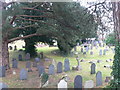
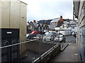
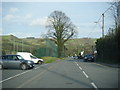
Photos of LL26 0AP


Area Information
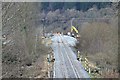
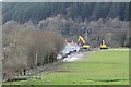
Living in LL26 0AP offers a quiet, tightly knit residential experience in a small cluster of homes in Wales. With a population of 2,045 and a density of 514 people per square kilometre, the area feels intimate, balancing proximity to essential services with a sense of seclusion. This postcode is ideal for those seeking a stable, mature community, as the median age of 47 suggests a predominance of established residents. Daily life here is shaped by local amenities and the surrounding natural environment, with easy access to rail stations and nearby schools. The area’s compact size means most needs are within practical reach, though its small scale also means it is best suited for those prioritising convenience over expansive urban offerings. LL26 0AP is not a place for the transient; it is a settlement where long-term residents form the core of the community, reflected in its 58% home ownership rate. Whether you are drawn to its low population density or the quiet rhythm of its streets, LL26 0AP provides a distinct alternative to larger towns.
- Area Type
- Postcode
- Area Size
- Not available
- Population
- 2045
- Population Density
- 514 people/km²
The property market in LL26 0AP is characterised by a high proportion of owner-occupied homes, with 58% of properties owned by residents. The accommodation type is predominantly houses, which is typical for smaller rural settlements where larger plots are available. This suggests a market that caters to families and individuals seeking private, low-density living. The small size of the area means the housing stock is limited, and buyers should consider proximity to nearby towns for broader options. The focus on homeownership indicates a stable market with little rental demand, which may appeal to those seeking long-term security. However, the lack of large-scale development means property choices are constrained, and buyers should prioritise properties in the immediate vicinity for practicality. The mix of houses also implies a quieter, more traditional living environment compared to urban areas.
House Prices in LL26 0AP
No properties found in this postcode.
Energy Efficiency in LL26 0AP
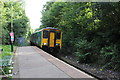
The lifestyle in LL26 0AP is shaped by its proximity to essential amenities and a focus on local convenience. Residents can access five rail stations, including Llanrwst Railway Station, which connects to nearby towns and services. For retail, three shops are within practical reach: Spar, Co-op Llanrwst, and Spar - Betws-Y, offering everyday essentials. While the area lacks large supermarkets or entertainment hubs, its small size ensures that most needs are met without long commutes. The absence of major leisure facilities means residents may need to travel to nearby towns for broader options, but the compact nature of LL26 0AP fosters a self-contained, community-oriented lifestyle. This balance of local amenities and rural tranquillity defines the character of daily life here.
Amenities
Schools
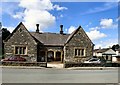
Residents of LL26 0AP have access to two schools: Ysgol Bro Gwydir and Ysgol Dyffryn Conwy, both listed as ‘other’ in the data. While specific Ofsted ratings are not provided, the presence of two schools suggests a range of educational options for families. The mix of school types may cater to different needs, though the exact nature of their curricula or specialisms is not detailed. For parents, this proximity to educational institutions is a key consideration, particularly for those prioritising ease of access to schooling. The relatively small area means that families may need to consider travel times to these schools, depending on their specific location within LL26 0AP. The availability of two schools also implies a community that supports local education, though further details on their performance or facilities are not included in the data.
| Rank | School | Type | Entry gender | Ages |
|---|
Explore more schools in this area
Go to Schools tabDemographics
The community in LL26 0AP is predominantly composed of adults aged 30 to 64, with a median age of 47. This suggests a mature, settled population, likely with strong family ties and long-term residency. Home ownership is high at 58%, indicating a stable housing market where most residents are homeowners rather than renters. The accommodation type is primarily houses, which aligns with the area’s small, residential character. The predominant ethnic group is White, reflecting the broader demographic patterns of rural Wales. While specific data on deprivation is not provided, the combination of high home ownership and a mature age profile suggests a community with relatively low economic pressure compared to more densely populated areas. This demographic profile shapes a lifestyle centred on stability, with limited turnover of residents and a focus on long-term living.
Household Size
Accommodation Type
Tenure
Ethnic Group
Religion
Household Composition
Age
Household Deprivation
NS-SEC
Explore more demographic insights in this area
Go to Demographics tabPlanning
Planning Constraints
- Flood RiskPremium
- Ramsar Wetland SitesPremium
- Area of Outstanding Natural BeautyPremium
- Protected Nature ReservePremium
- Protected WoodlandPremium
- Crime RiskPremium