Area Overview for LL22 8SX
Photos of LL22 8SX
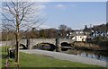

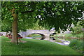
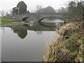
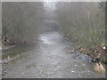


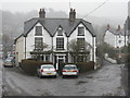
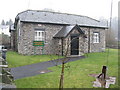
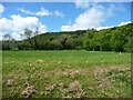
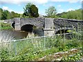
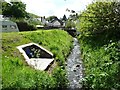
93 photos from this area
Area Information
Key information about the LL22 8SX including its size, population, and administrative classification.
- Area Type
- Postcode
- Area Size
- 1.7 hectares
- Population
- 1953
- Population Density
- 21 people/km²
House Prices in LL22 8SX
16
Properties
£140,983
Average Sold Price
£38,000
Lowest Price
£235,000
Highest Price
Showing 16 properties
| Address | Type | Beds | Baths | Last Sale Price | Last Sale Date | |
|---|---|---|---|---|---|---|
| 2 Llys Dolhaiarn, Llanfairtalhaiarn, LL22 8SX | Terraced | 2 | 2 | £145,000 | Apr 2025 | |
| 16 Llys Dolhaiarn, Llanfairtalhaiarn, LL22 8SX | house | 3 | 1 | £230,000 | Sep 2024 | |
| 3 Llys Dolhaiarn, Llanfairtalhaiarn, LL22 8SX | Terraced | 2 | 1 | £140,000 | Aug 2024 | |
| 5 Llys Dolhaiarn, Llanfairtalhaiarn, LL22 8SX | Semi-detached | 3 | 1 | £220,000 | Sep 2023 | |
| 4 Llys Dolhaiarn, Llanfairtalhaiarn, LL22 8SX | Terraced | 2 | 2 | £172,500 | Apr 2023 | |
| 14 Llys Dolhaiarn, Llanfairtalhaiarn, LL22 8SX | Detached | 4 | 1 | £165,000 | Jun 2018 | |
| 11 Llys Dolhaiarn, Llanfairtalhaiarn, LL22 8SX | Detached | 3 | 2 | £145,000 | Mar 2018 | |
| 8 Llys Dolhaiarn, Llanfairtalhaiarn, LL22 8SX | Terraced | 2 | - | £106,500 | Aug 2016 | |
| 12 Llys Dolhaiarn, Llanfairtalhaiarn, LL22 8SX | Detached | 3 | - | £163,000 | May 2014 | |
| 10 Llys Dolhaiarn, Llanfairtalhaiarn, LL22 8SX | house | - | - | £155,000 | Feb 2007 |
Page 1 of 2
Energy Efficiency in LL22 8SX
Amenities
Schools
| Rank | School | Type | Entry gender | Ages |
|---|
Explore more schools in this area
Go to Schools tabDemographics
Household Size
Two person
most common
Accommodation Type
Houses
most common
Tenure
72
majority
Ethnic Group
White
most common
Religion
N/A
most common
Household Composition
N/A
most common
Age
47
median
Adults (30-64 years)
most common
Household Deprivation
N/A
with no deprivation
NS-SEC
35
in Lower managerial occupations
Explore more demographic insights in this area
Go to Demographics tabPlanning
Planning Constraints
- Flood RiskPremium
- Ramsar Wetland SitesPremium
- Area of Outstanding Natural BeautyPremium
- Protected Nature ReservePremium
- Protected WoodlandPremium
- Crime RiskPremium