Area Overview for LL22 8FP
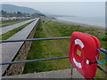
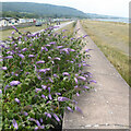
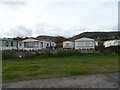
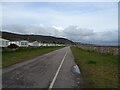
Photos of LL22 8FP
Area Information
Living in LL22 8FP means being part of a tightly knit residential cluster in north Wales, where 2009 people reside across 4.4 hectares. The area’s high population density of 1973 people per square kilometre reflects its compact nature, ideal for those seeking a close-knit community. This postcode is a microcosm of Welsh rural living, with homes predominantly in private ownership and a strong focus on local amenities. Daily life here balances proximity to essential services with the quietude of a small area. Residents benefit from nearby retail outlets and rail links, making it practical for both commuters and those preferring a slower pace. The area’s small size means neighbours are likely to know one another, fostering a sense of familiarity. For buyers, LL22 8FP offers a rare blend of accessibility and seclusion, with homes typically set in traditional Welsh architectural styles. Its location, while rural, is within reach of larger towns, offering flexibility without sacrificing the charm of a smaller postcode.
- Area Type
- Postcode
- Area Size
- 4.4 hectares
- Population
- 2009
- Population Density
- 1973 people/km²
The property market in LL22 8FP is characterised by high home ownership, with 82% of residents living in their own homes. This suggests a stable, owner-occupied market rather than a rental-heavy area. The accommodation type is exclusively houses, which is unusual for small postcode areas and indicates a focus on family-friendly or semi-detached housing. Given the area’s size and population density, properties are likely to be closely spaced, with limited scope for large developments. Buyers should consider that the market is not driven by speculative investment but by long-term residents seeking permanent homes. The small size of LL22 8FP means properties are unlikely to be available in large numbers, making it a niche market for those prioritising location over scale. Proximity to rail links and retail amenities further enhances the appeal for buyers seeking a balance between rural living and practicality.
House Prices in LL22 8FP
Showing 55 properties
| Address | Type | Beds | Baths | Last Sale Price | Last Sale Date | |
|---|---|---|---|---|---|---|
| 42 Cae Ddol, Abergele, LL22 8FP | Terraced | 3 | 3 | £210,000 | Jul 2025 | |
| 24 Cae Ddol, Abergele, LL22 8FP | house | - | - | £285,000 | Mar 2025 | |
| 6 Cae Ddol, Abergele, LL22 8FP | house | - | - | £278,000 | Mar 2025 | |
| 10 Cae Ddol, Abergele, LL22 8FP | Detached | 4 | 3 | £350,000 | Oct 2023 | |
| 23 Cae Ddol, Abergele, LL22 8FP | Semi-detached | 3 | 2 | £240,000 | Aug 2023 | |
| 33 Cae Ddol, Abergele, LL22 8FP | Retail | 3 | 2 | £208,000 | Jul 2022 | |
| 19 Cae Ddol, Abergele, LL22 8FP | Detached | 4 | 2 | £349,000 | Jan 2022 | |
| 13 Cae Ddol, Abergele, LL22 8FP | house | - | - | £269,000 | Jan 2022 | |
| 49 Cae Ddol, Abergele, LL22 8FP | house | - | - | £319,995 | Sep 2021 | |
| 48 Cae Ddol, Abergele, LL22 8FP | house | - | - | £269,995 | Sep 2021 |
Energy Efficiency in LL22 8FP
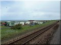
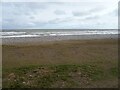
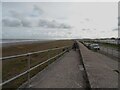
Residents of LL22 8FP have access to essential retail outlets within practical reach, including Tesco Abergele, Co-op Pensarn, and Spar. These stores provide everyday necessities, reducing the need for long trips to larger centres. The area’s rail links to Abergele & Pensarn, Rhyl, and Colwyn Bay stations offer convenient access to nearby towns, enhancing both social and economic opportunities. While the data does not specify parks or leisure facilities, the proximity to coastal towns like Rhyl and Colwyn Bay suggests recreational options such as beaches, walks, and local attractions are within reach. The combination of retail convenience and transport connectivity makes daily life efficient, allowing residents to balance local amenities with broader regional access. This blend of practicality and proximity to natural and cultural sites defines the lifestyle in LL22 8FP.
Amenities
Schools
| Rank | School | Type | Entry gender | Ages |
|---|
Explore more schools in this area
Go to Schools tabDemographics
The community in LL22 8FP is predominantly composed of adults aged 30–64, with a median age of 47. This suggests a mature population, likely with established careers and families. Home ownership is high, with 82% of residents living in their own homes, indicating stability and long-term commitment to the area. The accommodation type is primarily houses, reflecting a preference for single-family dwellings over flats or apartments. The predominant ethnic group is White, aligning with broader trends in rural Wales. The absence of specific data on deprivation or diversity means the area’s social dynamics are not quantified, but the high home ownership rate and age profile suggest a community focused on comfort and continuity. For prospective buyers, this demographic profile implies a neighbourhood where property values are likely to remain steady, and local services cater to older and middle-aged residents.
Household Size
Accommodation Type
Tenure
Ethnic Group
Religion
Household Composition
Age
Household Deprivation
NS-SEC
Explore more demographic insights in this area
Go to Demographics tabPlanning
Planning Constraints
- Flood RiskPremium
- Ramsar Wetland SitesPremium
- Area of Outstanding Natural BeautyPremium
- Protected Nature ReservePremium
- Protected WoodlandPremium
- Crime RiskPremium