Area Overview for LL22 8FH
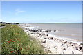
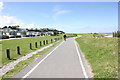
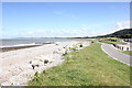
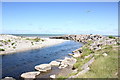
Photos of LL22 8FH

Area Information
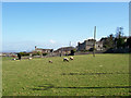
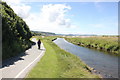
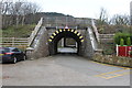
Living in LL22 8FH means inhabiting a small, tightly knit residential cluster in north Wales. Covering just 2.1 hectares, the area is compact but functional, with a population of 1,600 people spread across a density of 314 per square kilometre. This is a place where daily life revolves around local routines, with no sprawling developments to disrupt the quiet rhythm of the community. The postcode is part of a broader Welsh landscape, though its proximity to nearby towns like Colwyn Bay and Abergele offers easy access to larger services. Residents here are likely to be familiar with the surrounding countryside and the modest scale of the area. With a median age of 47, the population skews towards middle-aged adults, suggesting a stable, long-term presence. The area’s small size means that amenities are concentrated, and the community feel is likely to be close-knit, though the lack of large public spaces or commercial hubs may appeal to those seeking simplicity over urban convenience.
- Area Type
- Postcode
- Area Size
- 2.1 hectares
- Population
- 1600
- Population Density
- 314 people/km²
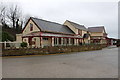
The property market in LL22 8FH is characterised by high home ownership and a focus on residential housing. With 80% of properties owner-occupied, this is not a rental-heavy area, suggesting a community of long-term residents rather than transient tenants. The accommodation type is predominantly houses, which is typical for smaller, rural or semi-rural postcodes. This means the housing stock is likely to be traditional, with limited high-density developments. For buyers, this presents a mix of opportunities and limitations: the area’s small size means the immediate surroundings are the primary market, and the lack of large-scale property diversity may appeal to those seeking a quiet, established home. However, the compact nature of LL22 8FH means that property choices are limited to the existing cluster, with no indication of recent or planned expansion. Buyers should consider the area’s size and the dominance of owner-occupied homes when assessing its long-term viability.
House Prices in LL22 8FH
Showing 1 properties
| Address | Type | Beds | Baths | Last Sale Price | Last Sale Date | |
|---|---|---|---|---|---|---|
| Llanddulas Village Hall, Beulah Avenue, Llanddulas, Abergele, LL22 8FH | commercial | - | - | - | - |
Energy Efficiency in LL22 8FH
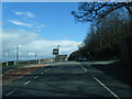
The lifestyle in LL22 8FH is shaped by its proximity to modest retail and transport hubs. Within practical reach are five retail outlets, including Tesco Abergele, Co-op Pensarn, and Aldi Old, offering everyday shopping needs. These stores suggest a focus on convenience rather than luxury, catering to the area’s mature population. The two nearby railway stations, Abergele & Pensarn and Colwyn Bay, provide access to broader networks, though the lack of additional amenities like parks or leisure facilities means the area’s character is defined by its simplicity. Residents may need to travel further for dining or entertainment, but the retail options and rail links offer a baseline of practicality. The absence of larger public spaces or cultural venues implies a lifestyle centred on local essentials rather than urban vibrancy.
Amenities
Schools
The only named school near LL22 8FH is Ysgol Llanddulas Controlled, which is listed as an "other" type in the data. No Ofsted rating is provided, so its educational standards cannot be assessed directly. The absence of other schools in the area suggests that families may need to look further afield for additional options, such as those in nearby towns like Colwyn Bay or Abergele. This could be a consideration for parents prioritising a range of school types, though the single listed school may suffice for some. The lack of data on school performance or diversity means that prospective buyers should investigate further, perhaps by contacting local authorities or visiting the school directly. For now, the presence of one educational institution indicates a basic level of provision, but the absence of others highlights a potential gap in the area’s infrastructure for growing families.
| Rank | School | Type | Entry gender | Ages |
|---|
Explore more schools in this area
Go to Schools tabDemographics
The demographic profile of LL22 8FH reflects a mature, settled population. With a median age of 47, the area is dominated by adults aged 30–64, indicating a community with established careers and families. Home ownership is high, with 80% of residents living in properties they own, suggesting a preference for stability over rental living. The accommodation type is predominantly houses, which aligns with the area’s small, residential character. The predominant ethnic group is White, and no data on diversity or deprivation is provided, though the high home ownership rate and age profile imply a relatively affluent, low-turnover population. This demographic structure means the area is likely to have a quiet, consistent social fabric, with fewer transient residents. The absence of specific data on deprivation or socioeconomic variation means the quality of life here can be inferred from the stability of its population and the lack of planning constraints.
Household Size
Accommodation Type
Tenure
Ethnic Group
Religion
Household Composition
Age
Household Deprivation
NS-SEC
Explore more demographic insights in this area
Go to Demographics tabPlanning
Planning Constraints
- Flood RiskPremium
- Ramsar Wetland SitesPremium
- Area of Outstanding Natural BeautyPremium
- Protected Nature ReservePremium
- Protected WoodlandPremium
- Crime RiskPremium