Area Overview for LL22 8DY
Photos of LL22 8DY
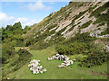
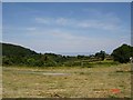
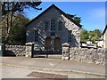
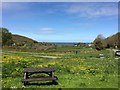
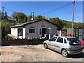
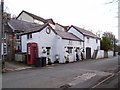
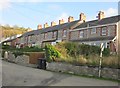
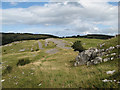
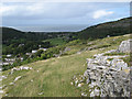
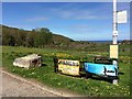
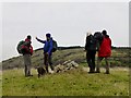
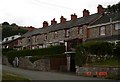
17 photos from this area
Area Information
Key information about the LL22 8DY including its size, population, and administrative classification.
- Area Type
- Postcode
- Area Size
- 9.1 hectares
- Population
- 1600
- Population Density
- 314 people/km²
House Prices in LL22 8DY
28
Properties
£282,545
Average Sold Price
£73,500
Lowest Price
£535,000
Highest Price
Showing 28 properties
| Address | Type | Beds | Baths | Last Sale Price | Last Sale Date | |
|---|---|---|---|---|---|---|
| Pen Y Gloddfa, Rhyd Y Foel Road, Rhyd Y Foel, Betws Yn Rhos, LL22 8DY | Detached | 4 | 2 | £535,000 | Mar 2025 | |
| Ivy Cottage, Rhyd Y Foel Road, Rhyd Y Foel, Betws Yn Rhos, LL22 8DY | house | 2 | 1 | £122,500 | Aug 2023 | |
| Y Graig, Rhyd Y Foel Road, Rhyd Y Foel, Betws Yn Rhos, LL22 8DY | Detached | 3 | 2 | £500,000 | Apr 2022 | |
| Dyffryn, Rhyd Y Foel Road, Rhyd Y Foel, Betws Yn Rhos, LL22 8DY | Bungalow | - | - | £238,000 | May 2021 | |
| 1, Tan Y Bryn, Rhyd Y Foel Road, Rhyd Y Foel, Betws Yn Rhos, LL22 8DY | house | - | - | £440,000 | Nov 2020 | |
| Awel Y Coed, Rhyd Y Foel Road, Rhyd Y Foel, Betws Yn Rhos, LL22 8DY | Detached | 4 | 1 | £390,000 | Sep 2018 | |
| Y Berllan, Rhyd Y Foel Road, Rhyd Y Foel, Betws Yn Rhos, LL22 8DY | Land | - | - | £114,000 | Aug 2018 | |
| Bryn Difel, Rhyd Y Foel Road, Rhyd Y Foel, Betws Yn Rhos, LL22 8DY | Bungalow | 2 | 1 | £140,000 | Jul 2016 | |
| Tan Y Corddyn, Plas Onn Road, Rhyd Y Foel, Betws Yn Rhos, LL22 8DY | Bungalow | 4 | - | £285,000 | Mar 2015 | |
| Bwthyn, Rhyd Y Foel Road, Rhyd Y Foel, Betws Yn Rhos, LL22 8DY | house | 1 | - | £73,500 | Dec 2013 |
Page 1 of 3
Energy Efficiency in LL22 8DY
Amenities
Schools
| Rank | School | Type | Entry gender | Ages |
|---|
Explore more schools in this area
Go to Schools tabDemographics
Household Size
Two person
most common
Accommodation Type
Houses
most common
Tenure
80
majority
Ethnic Group
White
most common
Religion
N/A
most common
Household Composition
N/A
most common
Age
47
median
Adults (30-64 years)
most common
Household Deprivation
N/A
with no deprivation
NS-SEC
32
in Lower managerial occupations
Explore more demographic insights in this area
Go to Demographics tabPlanning
Planning Constraints
- Flood RiskPremium
- Ramsar Wetland SitesPremium
- Area of Outstanding Natural BeautyPremium
- Protected Nature ReservePremium
- Protected WoodlandPremium
- Crime RiskPremium