Area Overview for LL18 5EU
Photos of LL18 5EU

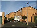
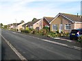


11 photos from this area
Area Information
Key information about the LL18 5EU including its size, population, and administrative classification.
- Area Type
- Postcode
- Area Size
- 2.3 hectares
- Population
- 1522
- Population Density
- 1659 people/km²
House Prices in LL18 5EU
10
Properties
£118,333
Average Sold Price
£87,500
Lowest Price
£152,500
Highest Price
Showing 10 properties
| Address | Type | Beds | Baths | Last Sale Price | Last Sale Date | |
|---|---|---|---|---|---|---|
| Swn Y Mor, 45 St Asaph Avenue, Kinmel Bay, LL18 5EU | Semi-detached | 2 | 1 | £152,500 | Jul 2021 | |
| Rose Cottage, 39 St Asaph Avenue, Kinmel Bay, LL18 5EU | Bungalow | - | - | £115,000 | Dec 2017 | |
| 41 St Asaph Avenue, Kinmel Bay, LL18 5EU | Bungalow | 3 | 1 | £87,500 | Mar 2012 | |
| The Outspan, 37 St Asaph Avenue, Kinmel Bay, LL18 5EU | Detached | 3 | 1 | - | - | |
| Beeson Brothers, The Tileries, St Asaph Avenue, Kinmel Bay, LL18 5EU | Industrial | - | - | - | - | |
| Unit 1, The Tileries, St Asaph Avenue, Kinmel Bay, LL18 5EU | office_workshop | - | - | - | - | |
| T J Discounts, Unit 5, Du Ross Yard, St Asaph Avenue, Kinmel Bay, LL18 5EU | Office | - | - | - | - | |
| Moston, 43 St Asaph Avenue, Kinmel Bay, LL18 5EU | Semi-detached | - | - | - | - | |
| 49 St Asaph Avenue, Kinmel Bay, LL18 5EU | Detached | - | - | - | - | |
| 47 St Asaph Avenue, Kinmel Bay, LL18 5EU | Detached | - | - | - | - |
Energy Efficiency in LL18 5EU
Amenities
Schools
| Rank | School | Type | Entry gender | Ages |
|---|
Explore more schools in this area
Go to Schools tabDemographics
Household Size
Family (3-5 people)
most common
Accommodation Type
Houses
most common
Tenure
64
majority
Ethnic Group
White
most common
Religion
N/A
most common
Household Composition
N/A
most common
Age
47
median
Adults (30-64 years)
most common
Household Deprivation
N/A
with no deprivation
NS-SEC
21
in Lower managerial occupations
Explore more demographic insights in this area
Go to Demographics tabPlanning
Planning Constraints
- Flood RiskPremium
- Ramsar Wetland SitesPremium
- Area of Outstanding Natural BeautyPremium
- Protected Nature ReservePremium
- Protected WoodlandPremium
- Crime RiskPremium