Area Overview for LL16 5LS
Photos of LL16 5LS
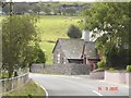
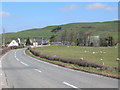
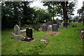
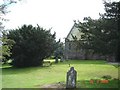
6 photos from this area
Area Information
Key information about the LL16 5LS including its size, population, and administrative classification.
- Area Type
- Postcode
- Area Size
- 1.0 km²
- Population
- 1819
- Population Density
- 14 people/km²
House Prices in LL16 5LS
15
Properties
£159,250
Average Sold Price
£137,000
Lowest Price
£190,000
Highest Price
Showing 15 properties
| Address | Type | Beds | Baths | Last Sale Price | Last Sale Date | |
|---|---|---|---|---|---|---|
| Joclyn Cottage, Taldrach To Nant Y Lladron, Bylchau, Llansannan, LL16 5LS | house | - | - | £150,000 | Mar 2011 | |
| Denmoor Bungalow, Taldrach To Nant Y Lladron, Bylchau, Llansannan, LL16 5LS | Bungalow | 3 | 2 | £137,000 | Mar 2009 | |
| The Old School House, Taldrach To Nant Y Lladron, Bylchau, Llansannan, LL16 5LS | house | - | - | £190,000 | Dec 2002 | |
| Llys Alys, Bylchau To Llys Y Delyn, Bylchau, Llansannan, LL16 5LS | Detached | - | - | £160,000 | Jul 2002 | |
| Bryn Greon, Bylchau To Llys Y Delyn, Bylchau, Llansannan, LL16 5LS | Bungalow | - | - | - | - | |
| Awelon, Bylchau To Llys Y Delyn, Bylchau, Llansannan, LL16 5LS | Detached | - | - | - | - | |
| Tyddyn Y Cyw, Taldrach To Nant Y Lladron, Bylchau, Llansannan, LL16 5LS | Detached | - | - | - | - | |
| Cartref, 4 Rhodfar Eglwys, Bylchau, Llansannan, LL16 5LS | Bungalow | - | - | - | - | |
| Bryn Eryl, 3 Rhodfar Eglwys, Bylchau, Llansannan, LL16 5LS | Semi-detached | - | - | - | - | |
| Y Bwthyn, Rhos To Bylchau, Bylchau, Llansannan, LL16 5LS | Bungalow | - | - | - | - |
Page 1 of 2
Energy Efficiency in LL16 5LS
Amenities
Schools
| Rank | School | Type | Entry gender | Ages |
|---|
Explore more schools in this area
Go to Schools tabDemographics
Household Size
Two person
most common
Accommodation Type
Houses
most common
Tenure
77
majority
Ethnic Group
White
most common
Religion
N/A
most common
Household Composition
N/A
most common
Age
47
median
Adults (30-64 years)
most common
Household Deprivation
N/A
with no deprivation
NS-SEC
33
in Lower managerial occupations
Explore more demographic insights in this area
Go to Demographics tabPlanning
Planning Constraints
- Flood RiskPremium
- Ramsar Wetland SitesPremium
- Area of Outstanding Natural BeautyPremium
- Protected Nature ReservePremium
- Protected WoodlandPremium
- Crime RiskPremium