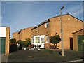
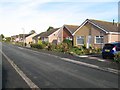
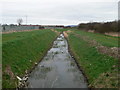
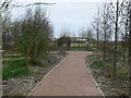
Area Overview for Kinmel Bay and Towyn Community
Photos of Kinmel Bay and Towyn Community


Area Information
You are buying a home in a small civil parish that covers 12.2 square kilometres. This 12.2 km² area holds a population of 4,427 residents, creating a tight-knit community where neighbours know each other. Living in Kinmel Bay and Towyn Community means settling into an environment where the vast majority of residents own their homes. You will find that 75 percent of households are owner-occupiers, which shapes the character of the village significantly. The community is distinct because it sits on the coast of Wales, offering a peaceful lifestyle away from the noise of major cities. Recent figures show there are 4,427 people living across this specific parish, giving you a clear picture of the local scale. Your daily life will likely involve quiet streets and a strong sense of established ownership within the boundaries of Kinmel Bay and Towyn Community. The population density stands at 364 people per square kilometre, indicating a moderate spread rather than urban congestion. You can expect a stable environment where long-term residents have likely been in Tewyn or Kinmel Bay for years. This demographic stability suggests a predictable, unchanging routine for anyone considering homes in this location. You will not find the rapid turnover typical of city centres, but rather a settled way of life tied to the specific geography of this parish. The area is defined by its residential nature and the fact that most people have stayed for the long term. When you move to Kinmel Bay and Towyn Community, you join a group of people who value stability and local ownership. Your experience here will be one of consistency, marked by the high rate of home ownership and the moderate population size.
- Area Type
- Parish
- Area Size
- 12.2 km²
- Population
- 4427
- Population Density
- 364 people/km²
Demographics
The age profile of Kinmel Bay and Towyn Community reveals an older population structure. The median age is recorded at 70 years, which means half the residents are at least this age. This demographic skew defines the social fabric of the parish and influences local services. You will see that the most common age range data is listed as 'Age: Total', reflecting the broad spread typical of a retirement or semi-retirement community. Home ownership rates are the defining statistic for household composition in this area, with 75 percent of residents owning their properties outright or with a mortgage. This high figure contrasts sharply with major towns where rental markets dominate. The accommodation type data confirms a total inventory tailored to this older demographic. While specific breakdowns of ethnic groups and religious affiliations are not detailed in the current figures, the homogeneity of home ownership suggests a cohesive local culture. This 75 percent ownership rate implies that selling second homes or investment properties is less common than buying to live in permanently. You should aim this area if you value a community driven by long-term residents rather than transient workers. The median age of 70 tells you that the schools and leisure facilities you access will cater to different life stages than a younger city district. Every sentence about this area must reflect this reality of an older, owner-occupied population. The data clearly shows a community where people have settled rather than just passing through. This demographic profile ensures a quiet atmosphere, as the resident base is primarily composed of older adults. The 75 percent home ownership rate also means fewer leasehold disputes or tenant eviction uncertainties for you as a buyer. You are entering a market defined by stability and a population that has aged together.
Household Size
Accommodation Type
Tenure
Ethnic Group
Religion
Household Composition
Age
Household Deprivation
NS-SEC
Explore more demographic insights in this area
Go to Demographics tabPlanning
Planning Constraints
- Flood RiskPremium
- Ramsar Wetland SitesPremium
- Area of Outstanding Natural BeautyPremium
- Protected Nature ReservePremium
- Protected WoodlandPremium
- Crime RiskPremium