Area Overview for Capel Curig Community
Photos of Capel Curig Community


Area Information
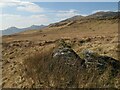
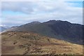
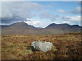
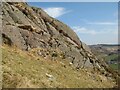
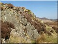
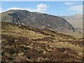
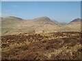
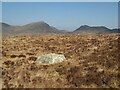
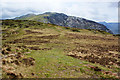
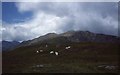
Capel Curig Community is a civil parish located in Wales with a total area of 78.4 km². Living in this Gebiet offers a distinctly rural experience characterised by vast open spaces and natural scenery. The parish stands apart from more urbanised districts due to its significant size and peaceful environment. You are entering a settlement where the landscape dominates daily life rather than high-rise development or dense urban planning. The sheer scale of 78.4 km² means that you will rarely encounter congestion or the noise associated with larger towns. This context shapes the rhythm of daily existence for everyone residing within the parish boundaries. Visitors and residents alike will notice the immediate presence of countryside features whenever they step outside their properties. The area functions as a self-contained community where the pace of life reflects its geographical isolation from major conurbations. Prospective buyers should expect a lifestyle defined by tranquility and a deep connection to the surrounding natural world. Understanding the true size and nature of this civil parish helps set accurate expectations for property value and lifestyle quality. You are not looking at a commuter hub but rather a destination for those seeking seclusion within the Welsh countryside.
- Area Type
- Parish
- Area Size
- 78.4 km²
- Population
- Not available
- Population Density
- Not available
Demographics
The population profile of Capel Curig Community reveals a distinctly older demographic structure. The median age in the parish sits at exactly 70 years old. This figure indicates that the majority of residents fall well into retirement age or later life stages. A home meant for a young family might face challenges finding suitable neighbours or local activities suited to a younger bracket. Most households in the area consist of older adults, which influences local spending habits and community engagement. Home ownership is extremely high within the parish, with 74% of residents owning their properties outright. This statistic suggests a stable community where long-term residents have established deep roots over generations. You are likely to encounter neighbours who have lived in Capel Curig Community for decades rather than transient workers or short-term renters. The accommodation type data does not specify single-person or multi-generational housing splits, reinforcing the idea of established households. The lack of noted youth populations or large families aligns with the high median age. When living in Capel Curig Community, you join a settled cohort where stability outweighs rapid demographic turnover. This demographic reality affects everything from local shop inventory to available community clubs.
Household Size
Accommodation Type
Tenure
Ethnic Group
Religion
Household Composition
Age
Household Deprivation
NS-SEC
Explore more demographic insights in this area
Go to Demographics tabPlanning
Planning Constraints
- Flood RiskPremium
- Ramsar Wetland SitesPremium
- Area of Outstanding Natural BeautyPremium
- Protected Nature ReservePremium
- Protected WoodlandPremium
- Crime RiskPremium