Area Overview for Betws Yn Rhos Community
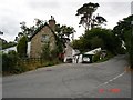
Photos of Betws Yn Rhos Community


Area Information
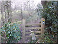
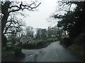
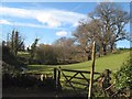
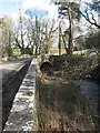
Betws Yn Rhos Community operates as a civil parish covering an extensive 48.8 square kilometres across the Welsh landscape. Living in this vast rural area offers a lifestyle defined by open space rather than urban density. The sheer size of the parish suggests that daily life involves significant distances between homes and amenities compared to city patches. You are likely to experience a quiet existence where neighbours may be separated by fields or miles of countryside. This parish provides a distinct alternative to the fast pace of town living for those seeking a slower rhythm. The environment here is spacious, allowing for a sense of seclusion that city dwellers rarely find. Residents enjoy the benefits of a large, uninterrupted area dominated by natural features rather than built-up zones. Your daily routine will be shaped by this layout, meaning you should plan for travel time to reach local shops or services. The simplicity of the parish structure supports a straightforward community dynamic without complex urban administration layers. Homes here sit within a setting that prioritises green space and low population density.
- Area Type
- Parish
- Area Size
- 48.8 km²
- Population
- Not available
- Population Density
- Not available
Demographics
The people calling Betws Yn Rhos Community home are significantly older than the national average across the region. Data shows a median age of 70 years, indicating that this is primarily a retirement location or destination for senior residents. You will find a community dominated by those in their seventh decade of life, which shapes the local social environment and service needs. The home ownership rate stands at 72 per cent, meaning most households own their properties outright or with a mortgage rather than renting. This high level of ownership suggests stability and long-term investment by residents who have put down roots in the parish. Accommodation types and household compositions reflect this demographic reality, likely featuring bungalows or upper-floor apartments suitable for mobility. While specific ethnic breakdowns and religious affiliations are not detailed in current records, the age profile clearly defines the primary users of this Welsh parish. The community design caters to an elderly population, influencing everything from local shop hours to transport accessibility. You can expect a quieter social scene focused on settling in for the long term rather than rapid turnover or transient living.
Household Size
Accommodation Type
Tenure
Ethnic Group
Religion
Household Composition
Age
Household Deprivation
NS-SEC
Explore more demographic insights in this area
Go to Demographics tabPlanning
Planning Constraints
- Flood RiskPremium
- Ramsar Wetland SitesPremium
- Area of Outstanding Natural BeautyPremium
- Protected Nature ReservePremium
- Protected WoodlandPremium
- Crime RiskPremium