Area Overview for SY23 5BW
Photos of SY23 5BW
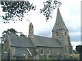
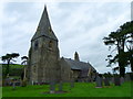
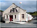
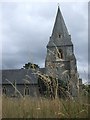
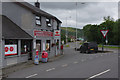
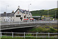
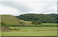
53 photos from this area
Area Information
Key information about the SY23 5BW including its size, population, and administrative classification.
- Area Type
- Postcode
- Area Size
- 2.7 hectares
- Population
- 1544
- Population Density
- 26 people/km²
House Prices in SY23 5BW
20
Properties
£121,600
Average Sold Price
£50,000
Lowest Price
£205,000
Highest Price
Showing 20 properties
| Address | Type | Beds | Baths | Last Sale Price | Last Sale Date | |
|---|---|---|---|---|---|---|
| 13 Heol Islwyn, Llanrhystud, SY23 5BW | Terraced | 3 | 1 | £205,000 | Oct 2024 | |
| Ceridfa, 16 Heol Islwyn, Llanrhystud, SY23 5BW | Terraced | - | - | £150,000 | Aug 2020 | |
| Maesymeillion, 19 Heol Islwyn, Llanrhystud, SY23 5BW | Terraced | 3 | 1 | £150,500 | Mar 2017 | |
| Awelon, 14 Heol Islwyn, Llanrhystud, SY23 5BW | Terraced | - | - | £52,500 | Jun 2001 | |
| Arwel, 8 Heol Islwyn, Llanrhystud, SY23 5BW | Terraced | - | - | £50,000 | Jul 1998 | |
| Glasfryn, 4 Heol Islwyn, Llanrhystud, SY23 5BW | Terraced | 3 | 1 | - | - | |
| Glyn Eiddwen, 12 Heol Islwyn, Llanrhystud, SY23 5BW | Terraced | 3 | 2 | - | - | |
| Dolawel, 3 Heol Islwyn, Llanrhystud, SY23 5BW | house | - | - | - | - | |
| Bryngwynno, 17 Heol Islwyn, Llanrhystud, SY23 5BW | house | - | - | - | - | |
| Bryneirin, 2 Heol Islwyn, Llanrhystud, SY23 5BW | house | - | - | - | - |
Page 1 of 2
Energy Efficiency in SY23 5BW
Amenities
Schools
| Rank | School | Type | Entry gender | Ages |
|---|
Explore more schools in this area
Go to Schools tabDemographics
Household Size
Two person
most common
Accommodation Type
Houses
most common
Tenure
79
majority
Ethnic Group
White
most common
Religion
N/A
most common
Household Composition
N/A
most common
Age
47
median
Adults (30-64 years)
most common
Household Deprivation
N/A
with no deprivation
NS-SEC
31
in Lower managerial occupations
Explore more demographic insights in this area
Go to Demographics tabPlanning
Planning Constraints
- Flood RiskPremium
- Ramsar Wetland SitesPremium
- Area of Outstanding Natural BeautyPremium
- Protected Nature ReservePremium
- Protected WoodlandPremium
- Crime RiskPremium