Area Overview for SY23 2HD
Photos of SY23 2HD
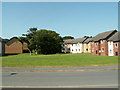


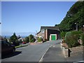
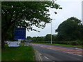
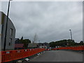
72 photos from this area
Area Information
Key information about the SY23 2HD including its size, population, and administrative classification.
- Area Type
- Postcode
- Area Size
- 8.4 hectares
- Population
- 2921
- Population Density
- 681 people/km²
House Prices in SY23 2HD
55
Properties
£191,408
Average Sold Price
£42,500
Lowest Price
£345,000
Highest Price
Showing 55 properties
| Address | Type | Beds | Baths | Last Sale Price | Last Sale Date | |
|---|---|---|---|---|---|---|
| Tyle Gwyn, 23 Dan Y Coed, Penglais, Aberystwyth, SY23 2HD | house | 3 | - | £345,000 | Aug 2024 | |
| 44 Dan Y Coed, Penglais, Aberystwyth, SY23 2HD | Flat | 2 | 1 | £177,000 | Sep 2022 | |
| 9 Dan Y Coed, Penglais, Aberystwyth, SY23 2HD | house | - | - | £285,000 | Jun 2022 | |
| 18 Dan Y Coed, Penglais, Aberystwyth, SY23 2HD | Detached | 3 | 2 | £305,000 | May 2022 | |
| 56 Dan Y Coed, Penglais, Aberystwyth, SY23 2HD | Retail | 3 | 1 | £285,000 | Apr 2022 | |
| 7 Dan Y Coed, Penglais, Aberystwyth, SY23 2HD | Semi-detached | 6 | 3 | £230,000 | Mar 2021 | |
| 35 Dan Y Coed, Penglais, Aberystwyth, SY23 2HD | house | - | - | £182,000 | Jan 2021 | |
| 13 Dan Y Coed, Penglais, Aberystwyth, SY23 2HD | house | - | - | £247,000 | Dec 2020 | |
| 22 Dan Y Coed, Penglais, Aberystwyth, SY23 2HD | Semi-detached | 3 | 3 | £255,000 | Sep 2020 | |
| 17 Dan Y Coed, Penglais, Aberystwyth, SY23 2HD | Detached | 4 | 3 | £320,000 | Jul 2020 |
Page 1 of 6
Energy Efficiency in SY23 2HD
Amenities
Schools
| Rank | School | Type | Entry gender | Ages |
|---|
Explore more schools in this area
Go to Schools tabDemographics
Household Size
Two person
most common
Accommodation Type
Houses
most common
Tenure
61
majority
Ethnic Group
White
most common
Religion
N/A
most common
Household Composition
N/A
most common
Age
22
median
Young Adults (15-29 years)
most common
Household Deprivation
N/A
with no deprivation
NS-SEC
14
in Lower managerial occupations
Explore more demographic insights in this area
Go to Demographics tabPlanning
Planning Constraints
- Flood RiskPremium
- Ramsar Wetland SitesPremium
- Area of Outstanding Natural BeautyPremium
- Protected Nature ReservePremium
- Protected WoodlandPremium
- Crime RiskPremium