Area Overview for SY23 1NB
Photos of SY23 1NB
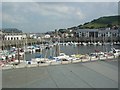
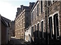
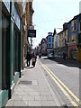
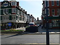
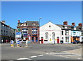
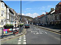
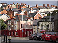
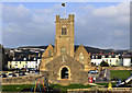
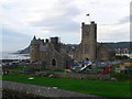

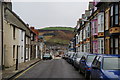
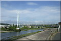
100 photos from this area
Area Information
Key information about the SY23 1NB including its size, population, and administrative classification.
- Area Type
- Postcode
- Area Size
- 1.2 hectares
- Population
- 1355
- Population Density
- 2432 people/km²
House Prices in SY23 1NB
20
Properties
£294,600
Average Sold Price
£43,000
Lowest Price
£511,000
Highest Price
Showing 20 properties
| Address | Type | Beds | Baths | Last Sale Price | Last Sale Date | |
|---|---|---|---|---|---|---|
| Solway, Buarth Road, Aberystwyth, SY23 1NB | Terraced | 4 | 1 | £370,000 | Jan 2025 | |
| Buarth Lodge, Buarth Road, Aberystwyth, SY23 1NB | Detached | 4 | 1 | £511,000 | Sep 2023 | |
| Brynhyfryd, Buarth Road, Aberystwyth, SY23 1NB | house | - | - | £325,000 | Apr 2022 | |
| Highlands, Buarth Road, Aberystwyth, SY23 1NB | Terraced | 6 | 2 | £270,000 | Jan 2022 | |
| Trinity House, Buarth Road, Aberystwyth, SY23 1NB | Semi-detached | 4 | 1 | £290,000 | Jul 2018 | |
| Bancrug, Buarth Road, Aberystwyth, SY23 1NB | house | - | - | £275,000 | Jan 2017 | |
| Ardwyn House, Buarth Road, Aberystwyth, SY23 1NB | Terraced | 6 | 2 | £260,000 | Feb 2015 | |
| Brynarfor, Buarth Road, Aberystwyth, SY23 1NB | Semi-detached | - | - | £330,000 | Dec 2007 | |
| Glanaber, Buarth Road, Aberystwyth, SY23 1NB | Terraced | - | - | £272,000 | Feb 2007 | |
| Gwynant, Buarth Road, Aberystwyth, SY23 1NB | Terraced | - | - | £43,000 | May 1999 |
Page 1 of 2
Energy Efficiency in SY23 1NB
Amenities
Schools
| Rank | School | Type | Entry gender | Ages |
|---|
Explore more schools in this area
Go to Schools tabDemographics
Household Size
One person
most common
Accommodation Type
Houses
most common
Tenure
51
majority
Ethnic Group
White
most common
Religion
N/A
most common
Household Composition
N/A
most common
Age
22
median
Young Adults (15-29 years)
most common
Household Deprivation
N/A
with no deprivation
NS-SEC
34
in Lower managerial occupations
Explore more demographic insights in this area
Go to Demographics tabPlanning
Planning Constraints
- Flood RiskPremium
- Ramsar Wetland SitesPremium
- Area of Outstanding Natural BeautyPremium
- Protected Nature ReservePremium
- Protected WoodlandPremium
- Crime RiskPremium