Area Overview for SY23 1BE
Photos of SY23 1BE
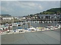
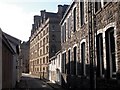
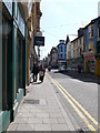
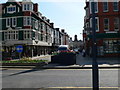
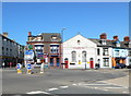
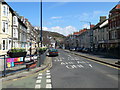
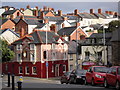
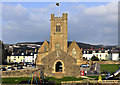
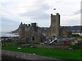

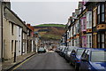
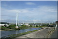
100 photos from this area
Area Information
Key information about the SY23 1BE including its size, population, and administrative classification.
- Area Type
- Postcode
- Area Size
- 8653 m²
- Population
- 1007
- Population Density
- 1512 people/km²
House Prices in SY23 1BE
18
Properties
£119,094
Average Sold Price
£49,000
Lowest Price
£187,000
Highest Price
Showing 18 properties
| Address | Type | Beds | Baths | Last Sale Price | Last Sale Date | |
|---|---|---|---|---|---|---|
| Avondale, Penparcau Road, Trefechan, Aberystwyth, SY23 1BE | Terraced | 6 | 1 | £148,250 | Oct 2025 | |
| 2, Ty Ceffyl Du, Penparcau Road, Trefechan, Aberystwyth, SY23 1BE | Semi-detached | 5 | 5 | £187,000 | May 2025 | |
| Brynawel, 0 , Trefechan, Aberystwyth, SY23 1BE | Terraced | 3 | 1 | £140,000 | Oct 2019 | |
| Morolwg, Penparcau Road, Trefechan, Aberystwyth, SY23 1BE | Terraced | 3 | 1 | £107,500 | Dec 2018 | |
| Limerick House, Penparcau Road, Trefechan, Aberystwyth, SY23 1BE | Terraced | - | - | £154,000 | Jan 2008 | |
| Twll Cacwn, Penparcau Road, Trefechan, Aberystwyth, SY23 1BE | Terraced | 4 | 1 | £87,000 | Nov 2002 | |
| Western Villa, Penparcau Road, Trefechan, Aberystwyth, SY23 1BE | house | 6 | 3 | £80,000 | Nov 2001 | |
| Cartref, Penparcau Road, Trefechan, Aberystwyth, SY23 1BE | Terraced | 2 | 1 | £49,000 | Apr 1998 | |
| Ground Floor Flat, Maes Y Coed, Penparcau Road, Trefechan, Aberystwyth, SY23 1BE | Flat | 1 | 1 | - | - | |
| Flat 1, Ravenscroft, Penparcau Road, Trefechan, Aberystwyth, SY23 1BE | Flat | - | - | - | - |
Page 1 of 2
Energy Efficiency in SY23 1BE
Amenities
Schools
| Rank | School | Type | Entry gender | Ages |
|---|
Explore more schools in this area
Go to Schools tabDemographics
Household Size
One person
most common
Accommodation Type
Houses
most common
Tenure
57
majority
Ethnic Group
White
most common
Religion
N/A
most common
Household Composition
N/A
most common
Age
47
median
Adults (30-64 years)
most common
Household Deprivation
N/A
with no deprivation
NS-SEC
33
in Lower managerial occupations
Explore more demographic insights in this area
Go to Demographics tabPlanning
Planning Constraints
- Flood RiskPremium
- Ramsar Wetland SitesPremium
- Area of Outstanding Natural BeautyPremium
- Protected Nature ReservePremium
- Protected WoodlandPremium
- Crime RiskPremium