Area Overview for SY20 8PG
Photos of SY20 8PG
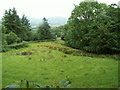
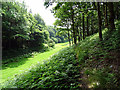
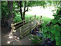

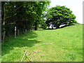


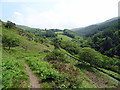
33 photos from this area
Area Information
Key information about the SY20 8PG including its size, population, and administrative classification.
- Area Type
- Postcode
- Area Size
- 60.2 hectares
- Population
- 1863
- Population Density
- 15 people/km²
House Prices in SY20 8PG
24
Properties
£385,900
Average Sold Price
£280,000
Lowest Price
£625,000
Highest Price
Showing 24 properties
| Address | Type | Beds | Baths | Last Sale Price | Last Sale Date | |
|---|---|---|---|---|---|---|
| Hafod Bach, Coed Y Garth From A 487 T To C 1133, Furnace, SY20 8PG | Bungalow | 3 | 3 | £625,000 | Aug 2023 | |
| Angorfa, Coed Y Garth From A 487 T To C 1133, Furnace, SY20 8PG | Bungalow | 4 | 2 | £330,000 | Aug 2017 | |
| Garth House, Coed Y Garth From A 487 T To C 1133, Furnace, SY20 8PG | house | - | - | £280,000 | Mar 2016 | |
| Bracken Wood, 0 , Furnace, Machynlleth, SY20 8PG | Detached | 4 | 2 | £299,500 | May 2014 | |
| Robin Hill, Coed Y Garth From A 487 T To C 1133, Furnace, SY20 8PG | house | - | - | £395,000 | Nov 2009 | |
| Y Garth, A 487 T From Furnace To The Entrance Of Ynys Greigog, Furnace, SY20 8PG | Detached | 3 | 2 | - | - | |
| Luangwa, Coed Y Garth From A 487 T To C 1133, Furnace, SY20 8PG | Bungalow | 3 | 2 | - | - | |
| Bryneryl, Coed Y Garth From A 487 T To C 1133, Furnace, SY20 8PG | Bungalow | 3 | 2 | - | - | |
| Quarter Deck, Coed Y Garth From A 487 T To C 1133, Furnace, SY20 8PG | Bungalow | 3 | 2 | - | - | |
| Pen Y Bryn, Coed Y Garth From A 487 T To C 1133, Furnace, SY20 8PG | house | 4 | 2 | - | - |
Page 1 of 3
Energy Efficiency in SY20 8PG
Amenities
Schools
| Rank | School | Type | Entry gender | Ages |
|---|
Explore more schools in this area
Go to Schools tabDemographics
Household Size
Two person
most common
Accommodation Type
Houses
most common
Tenure
80
majority
Ethnic Group
White
most common
Religion
N/A
most common
Household Composition
N/A
most common
Age
47
median
Adults (30-64 years)
most common
Household Deprivation
N/A
with no deprivation
NS-SEC
37
in Lower managerial occupations
Explore more demographic insights in this area
Go to Demographics tabPlanning
Planning Constraints
- Flood RiskPremium
- Ramsar Wetland SitesPremium
- Area of Outstanding Natural BeautyPremium
- Protected Nature ReservePremium
- Protected WoodlandPremium
- Crime RiskPremium