Area Overview for SA48 8QY
Photos of SA48 8QY
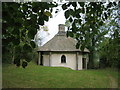
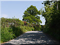
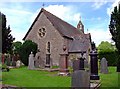
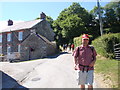
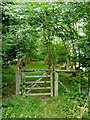
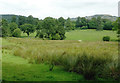
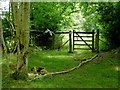
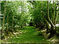

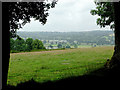
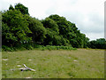
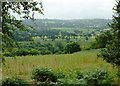
19 photos from this area
Area Information
Key information about the SA48 8QY including its size, population, and administrative classification.
- Area Type
- Postcode
- Area Size
- 44.5 hectares
- Population
- 2036
- Population Density
- 28 people/km²
House Prices in SA48 8QY
8
Properties
£360,492
Average Sold Price
£90,000
Lowest Price
£765,000
Highest Price
Showing 8 properties
| Address | Type | Beds | Baths | Last Sale Price | Last Sale Date | |
|---|---|---|---|---|---|---|
| Mill Ponds, From U 1566 To Property At Cilbwn Private, Talsarn, SA48 8QY | Land | 4 | 4 | £735,000 | Jul 2024 | |
| Wern Fach, U 1566 From The Junction Of The B 4337 To The Bridge At Wern Cottage, Talsarn, SA48 8QY | Land | 3 | 2 | £765,000 | Aug 2023 | |
| Tawelfan, U 1566 From The Junction Of The B 4337 To The Bridge At Wern Cottage, Talsarn, SA48 8QY | Cottage | 3 | 1 | £180,000 | Jun 2017 | |
| Wern Cottage, U 1566 From The Junction Of The B 4337 To The Bridge At Wern Cottage, Talsarn, SA48 8QY | Semi-detached | 2 | - | £90,000 | May 2012 | |
| Glenydd, U 1566 From The Junction Of The B 4337 To The Bridge At Wern Cottage, Talsarn, SA48 8QY | Detached | - | - | £172,950 | Jun 2007 | |
| Cilbwn, From U 1566 To Property At Cilbwn Private, Talsarn, SA48 8QY | Terraced | - | - | £220,000 | Jan 2000 | |
| Aelybryn, U 1566 From The Junction Of The B 4337 To The Bridge At Wern Cottage, Talsarn, SA48 8QY | Detached | 4 | 2 | - | - | |
| The Garden, From U 1566 To Property At Cilbwn Private, Talsarn, SA48 8QY | Detached | - | - | - | - |
Energy Efficiency in SA48 8QY
Amenities
Schools
| Rank | School | Type | Entry gender | Ages |
|---|
Explore more schools in this area
Go to Schools tabDemographics
Household Size
Two person
most common
Accommodation Type
Houses
most common
Tenure
75
majority
Ethnic Group
White
most common
Religion
N/A
most common
Household Composition
N/A
most common
Age
47
median
Adults (30-64 years)
most common
Household Deprivation
N/A
with no deprivation
NS-SEC
27
in Lower managerial occupations
Explore more demographic insights in this area
Go to Demographics tabPlanning
Planning Constraints
- Flood RiskPremium
- Ramsar Wetland SitesPremium
- Area of Outstanding Natural BeautyPremium
- Protected Nature ReservePremium
- Protected WoodlandPremium
- Crime RiskPremium