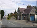
Area Overview for SA46 0EA
Photos of SA46 0EA


Area Information
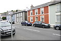
SA46 0EA is a small residential cluster located in Wales, comprising a total area of 9,025 square metres. The community comprises 1,268 residents, creating a population density of 802 people per square kilometre. Living in SA46 0EA means occupying a space that balances proximity with a sense of quiet residential character. The specific postcode covers a tight geographical boundary, which limits the number of homes and influences the local atmosphere. This area functions as a distinct pocket within the broader region, offering residents a defined environment rather than a sprawling neighbourhood. Daily life revolves around a close-knit set of residents who share the same immediate surroundings. The compact size ensures that every property is within a short distance of its neighbours, fostering an environment where community ties are naturally strong. Potential buyers should note that this is a very specific location where the built environment is fixed and known. The area does not represent a suburb but a precise cluster defined by its postcode boundary. Understanding the scale is important for those visualising their future life here. The 9,025 square metres represent the total footprint of this residential zone, meaning the infrastructure and amenities are concentrated within a small radius. You will experience a lifestyle defined by this intimacy and limited expansion.
- Area Type
- Postcode
- Area Size
- 9025 m²
- Population
- 1268
- Population Density
- 802 people/km²
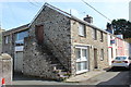
The property market in SA46 0EA is characterised by a strong domestic ownership culture, with home ownership reaching 65 per cent of the local population. This figure indicates that the majority of residents purchase their homes rather than renting, creating a market driven by first-time buyers, families, and retirees. Houses dominate the local housing stock, confirming that you will search primarily for residential properties suited to family living. The accommodation type is exclusively listed as houses, meaning flats or apartments are not a feature of this specific postcode area. With a population of 1,268 across a small 9,025 square metre footprint, the number of available homes for sale will be limited at any given time. Competition may be higher since the total inventory is intrinsic to the small size of the postcode. You should focus your search on the specific cluster defined by SA46 0EA, as neighbouring areas may offer different housing types. The high ownership rate suggests that properties often spend many years with the same family, potentially leading to gradual improvements and maintenance over time. When browsing for homes in SA46 0EA, expect to find traditional residential structures adapted for long-term living. The market here is not a transient rental hub but a place where roots are planted permanently.
House Prices in SA46 0EA
No properties found in this postcode.
Energy Efficiency in SA46 0EA
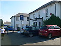
Your daily lifestyle in SA46 0EA centres on practical convenience provided by nearby retail outlets and local infrastructure. The nearest significant amenity is Morrisons Daily Ffos Y, which serves as the primary retail destination for groceries and essential goods. This single major outlet is situated within a practical reach of all residents in the postcode area. With a population of 1,268 people, the convenience of having Morrisons is a key feature of the local shopping experience. You will have access to fresh food and household supplies without needing to travel far beyond the immediate vicinity. The area does not boast a wider high street, so planning your shopping trips around this specific store is advisable. Living in SA46 0EA means relying on this designated retail hub for your main shopping needs. The simplicity of having one major named amenity reduces travel time and simplifies the logistics of daily errands. Residents appreciate the ease of accessing Morrisons Daily Ffos Y, which anchors the commercial life of this small cluster. While there are no other large shopping centres listed, the proximity to this daily store ensures that basic needs are met efficiently. The lifestyle is defined by this functional connection to a reliable supermarket rather than a range of diversified entertainment or leisure venues.
Amenities
Schools
Families living in SA46 0EA have access to three nearby educational institutions, all categorised as other schools within the local vicinity. The nearest options include Ysgol Gynradd Aberaeron, Ysgol Penlon, and Ysgol Gyfun Aberaeron. These schools serve the broader Aberaeron community, providing education for children residing in SA46 0EA and its immediate surroundings. Ysgol Gynradd Aberaeron typically serves as a primary level institution, while Ysgol Gyfun Aberaeron usually functions as a secondary or mixed school. Ysgol Penlon acts as the third key educational provision in the area. Choosing schools in this context means you are selecting from established Welsh-medium or integrated education providers common to the region. The presence of these specific schools gives residents certainty about educational pathways without needing to travel far from home. You do not need to commute long distances to secure education for your children, as these facilities are designated as schools near SA46 0EA. Each institution offers a distinct curriculum environment, allowing parents to choose based on their specific educational philosophy. The availability of these three named schools ensures that locality-based schooling is a straightforward reality for residents in this postcode.
| Rank | School | Type | Entry gender | Ages |
|---|
Explore more schools in this area
Go to Schools tabDemographics
The community in SA46 0EA is defined by a median age of 47 years, indicating a mature population base. Most residents fall into the 30 to 64 year age range, suggesting the area hosts established families and working-aged adults. Home ownership stands at 65 per cent, which is significantly higher than the rental sector present here. This high level of ownership implies a stable resident base with a long-term commitment to the locality. Houses form the predominant accommodation type, aligning with the home ownership figures and suggesting a family-oriented housing stock. The predominant ethnic group is White, reflecting the demographic composition of the surrounding region. You will find a community where residents have likely lived for many years, contributing to a consistent social fabric. There are no significant fluctuations in age or household composition to disrupt the daily rhythm of life. The 65 per cent home ownership rate means that a majority of occupants have equity in their properties and may be less likely to move frequently. This stability often correlates with well-maintained homes and engaged neighbourhood associations. For those seeking a settled environment, the age profile and ownership stats provide clear indicators of what to expect from the people in SA46 0EA.
Household Size
Accommodation Type
Tenure
Ethnic Group
Religion
Household Composition
Age
Household Deprivation
NS-SEC
Explore more demographic insights in this area
Go to Demographics tabPlanning
Planning Constraints
- Flood RiskPremium
- Ramsar Wetland SitesPremium
- Area of Outstanding Natural BeautyPremium
- Protected Nature ReservePremium
- Protected WoodlandPremium
- Crime RiskPremium