Area Overview for SA44 4LP
Photos of SA44 4LP
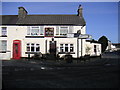
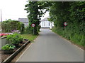
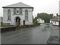
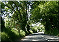
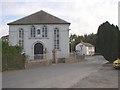
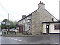
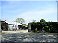
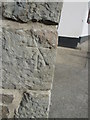
11 photos from this area
Area Information
Key information about the SA44 4LP including its size, population, and administrative classification.
- Area Type
- Postcode
- Area Size
- 42.5 hectares
- Population
- 1199
- Population Density
- 20 people/km²
House Prices in SA44 4LP
14
Properties
£140,083
Average Sold Price
£50,000
Lowest Price
£267,000
Highest Price
Showing 14 properties
| Address | Type | Beds | Baths | Last Sale Price | Last Sale Date | |
|---|---|---|---|---|---|---|
| Blaenmene, 0 , Prengwyn, Llandysul, SA44 4LP | house | 3 | 1 | £267,000 | Feb 2019 | |
| Gwernffrwd, A 475 Prengwyn, Prengwyn, SA44 4LP | Detached | - | - | £200,000 | Dec 2010 | |
| Tanybryn, A 475 Prengwyn, Prengwyn, SA44 4LP | house | - | - | £120,000 | Aug 2010 | |
| Tancapel, A 475 Prengwyn, Prengwyn, SA44 4LP | house | - | - | £145,000 | Mar 2006 | |
| Castle Green, A 475 Prengwyn, Prengwyn, SA44 4LP | Detached | - | - | £58,500 | Aug 1998 | |
| Llwynon, A 475 Prengwyn, Prengwyn, SA44 4LP | Detached | - | - | £50,000 | Nov 1996 | |
| Neuadd Isaf, A 475 Prengwyn, Prengwyn, SA44 4LP | Flat | - | - | - | - | |
| Neuadd Uchaf, A 475 Prengwyn, Prengwyn, SA44 4LP | Flat | - | - | - | - | |
| Pantdefaid, A 475 From Prengwyn To Pant Y Defaid, Prengwyn, SA44 4LP | Semi-detached | - | - | - | - | |
| Gwylfa, A 475 Prengwyn, Prengwyn, SA44 4LP | Detached | - | - | - | - |
Page 1 of 2
Energy Efficiency in SA44 4LP
Amenities
Schools
| Rank | School | Type | Entry gender | Ages |
|---|
Explore more schools in this area
Go to Schools tabDemographics
Household Size
Two person
most common
Accommodation Type
Houses
most common
Tenure
84
majority
Ethnic Group
White
most common
Religion
N/A
most common
Household Composition
N/A
most common
Age
47
median
Adults (30-64 years)
most common
Household Deprivation
N/A
with no deprivation
NS-SEC
27
in Lower managerial occupations
Explore more demographic insights in this area
Go to Demographics tabPlanning
Planning Constraints
- Flood RiskPremium
- Ramsar Wetland SitesPremium
- Area of Outstanding Natural BeautyPremium
- Protected Nature ReservePremium
- Protected WoodlandPremium
- Crime RiskPremium