Area Overview for SA43 2AR
Photos of SA43 2AR
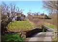
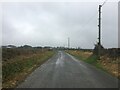
2 photos from this area
Area Information
Key information about the SA43 2AR including its size, population, and administrative classification.
- Area Type
- Postcode
- Area Size
- 1.1 km²
- Population
- 1763
- Population Density
- 35 people/km²
House Prices in SA43 2AR
38
Properties
£206,353
Average Sold Price
£51,500
Lowest Price
£512,500
Highest Price
Showing 38 properties
| Address | Type | Beds | Baths | Last Sale Price | Last Sale Date | |
|---|---|---|---|---|---|---|
| Gelli Aur, Bowls Road, Blaenporth, SA43 2AR | Detached | 5 | 2 | £512,500 | Dec 2025 | |
| Afallon, Bowls Road, Blaenporth, SA43 2AR | Bungalow | 3 | 1 | £332,500 | Jan 2025 | |
| Cae Argored, Bowls Road, Blaenporth, SA43 2AR | Bungalow | 3 | 2 | £360,000 | Nov 2023 | |
| 3A Bowls Road, Blaenporth, SA43 2AR | house | - | - | £235,000 | Aug 2021 | |
| Rivendell, Bowls Road, Blaenporth, SA43 2AR | Bungalow | 3 | 1 | £255,000 | Jul 2020 | |
| Noddfa, Bowls Road, Blaenporth, SA43 2AR | Bungalow | 2 | 1 | £185,000 | Jan 2020 | |
| Pantglas, 0 Bowls Road, Blaenporth, Cardigan, SA43 2AR | Detached | 4 | 3 | £125,000 | Sep 2019 | |
| 3B Bowls Road, Blaenporth, SA43 2AR | Semi-detached | 3 | 2 | £238,000 | Jan 2019 | |
| Ardwyn, Bowls Road, Blaenporth, SA43 2AR | Detached | 5 | 2 | £205,000 | Jul 2017 | |
| Sibrwd Y Coed, Bowls Road, Blaenporth, SA43 2AR | Bungalow | 3 | - | £193,000 | Dec 2015 |
Page 1 of 4
Energy Efficiency in SA43 2AR
Amenities
Schools
| Rank | School | Type | Entry gender | Ages |
|---|
Explore more schools in this area
Go to Schools tabDemographics
Household Size
Two person
most common
Accommodation Type
Houses
most common
Tenure
81
majority
Ethnic Group
White
most common
Religion
N/A
most common
Household Composition
N/A
most common
Age
47
median
Adults (30-64 years)
most common
Household Deprivation
N/A
with no deprivation
NS-SEC
31
in Lower managerial occupations
Explore more demographic insights in this area
Go to Demographics tabPlanning
Planning Constraints
- Flood RiskPremium
- Ramsar Wetland SitesPremium
- Area of Outstanding Natural BeautyPremium
- Protected Nature ReservePremium
- Protected WoodlandPremium
- Crime RiskPremium