Area Overview for SA43 1PH
Photos of SA43 1PH
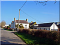
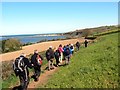
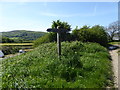
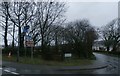
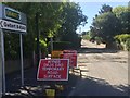
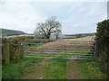
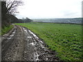
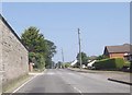
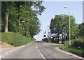
18 photos from this area
Area Information
Key information about the SA43 1PH including its size, population, and administrative classification.
- Area Type
- Postcode
- Area Size
- 67.1 hectares
- Population
- 1862
- Population Density
- 304 people/km²
House Prices in SA43 1PH
50
Properties
£263,823
Average Sold Price
£82,500
Lowest Price
£535,000
Highest Price
Showing 50 properties
| Address | Type | Beds | Baths | Last Sale Price | Last Sale Date | |
|---|---|---|---|---|---|---|
| Swn Y Deryn, Gwbert Road, Cardigan, SA43 1PH | Detached | 4 | 2 | £535,000 | Jun 2025 | |
| Clydfan, Gwbert Road, Cardigan, SA43 1PH | Bungalow | 2 | 1 | £272,500 | Jun 2025 | |
| Caeronen, Gwbert Road, Cardigan, SA43 1PH | Detached | 3 | 1 | £347,000 | Jul 2024 | |
| Henfaes, Gwbert Road, Cardigan, SA43 1PH | Detached | 3 | 3 | £385,000 | Oct 2021 | |
| Rookwood, Tregibby Lane, Cardigan, SA43 1PH | Bungalow | - | - | £239,950 | Apr 2021 | |
| Glenwood, Gwbert Road, Cardigan, SA43 1PH | house | - | - | £360,000 | Dec 2020 | |
| Doldrement, Gwbert Road, Cardigan, SA43 1PH | Bungalow | 4 | 2 | £388,000 | Nov 2018 | |
| Erw Wen, Gwbert Road, Cardigan, SA43 1PH | Detached | 4 | 2 | £357,000 | Jun 2018 | |
| Swn Y Mor, Gwbert Road, Cardigan, SA43 1PH | Detached | 4 | 3 | £285,000 | Apr 2017 | |
| Cil Y Coed, Tregibby Lane, Cardigan, SA43 1PH | Semi-detached | 3 | - | £145,000 | Dec 2015 |
Page 1 of 5
Energy Efficiency in SA43 1PH
Amenities
Schools
| Rank | School | Type | Entry gender | Ages |
|---|
Explore more schools in this area
Go to Schools tabDemographics
Household Size
Two person
most common
Accommodation Type
Houses
most common
Tenure
70
majority
Ethnic Group
White
most common
Religion
N/A
most common
Household Composition
N/A
most common
Age
47
median
Adults (30-64 years)
most common
Household Deprivation
N/A
with no deprivation
NS-SEC
30
in Lower managerial occupations
Explore more demographic insights in this area
Go to Demographics tabPlanning
Planning Constraints
- Flood RiskPremium
- Ramsar Wetland SitesPremium
- Area of Outstanding Natural BeautyPremium
- Protected Nature ReservePremium
- Protected WoodlandPremium
- Crime RiskPremium