Area Overview for SA43 1DE
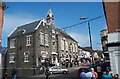
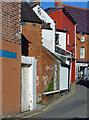
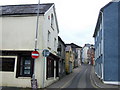
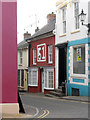
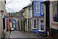
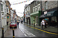
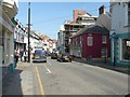
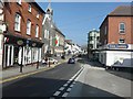
Photos of SA43 1DE


Area Information
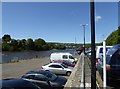
Living in SA43 1DE offers a distinct experience within a specific residential cluster located in Wales. This postcode covers a small area with a total population of 1,174 residents, resulting in a density of 246 people per square kilometre. You will find that life here moves at a measured pace compared to larger urban centres. The character of the neighbourhood is defined by its compact nature and the specific mix of households inhabiting this rural postcode. Residents enjoy the benefits of a close-knit community while maintaining proximity to essential services in nearby towns. This location serves as a quiet home base for those who prioritise space and tranquility over the immediacy of extensive city infrastructure. The area provides a stable environment where daily routines are structured around local facilities and reliable transport links to Cardigan. Understanding the scale of this postcode helps you appreciate its role as a focused residential zone rather than a sprawling suburb. The demographic profile suggests a mature community settled into long-term homes. Practical considerations such as flood risk and planning constraints are straightforward, with no significant environmental limitations imposing restrictions on the area. Your days here will likely involve a commute to the wider region while returning to a contained, manageable living space. The small scale ensures that neighbours are within sight and the local identity remains strong.
- Area Type
- Postcode
- Area Size
- Not available
- Population
- 1174
- Population Density
- 246 people/km²
The property market in SA43 1DE centres primarily on houses, reflecting the accommodation type data for this specific postcode. This indicates a housing stock focused on individual family homes rather than high-density flats or apartments. With a home ownership rate of 40%, the area presents a split market where a substantial portion of residents are landlords or private renters. This dynamic is common in rural Welsh postcodes where property values and rental yields operate under different pressures than in major cities. Buyers looking for homes in SA43 1DE will find a limited selection due to the small population of 1,174. However, this scarcity often results in peaceful streets and low traffic volumes. The smaller scale means that maintenance of properties can be challenging for remote buyers, as local tradespeople may have higher demand during peak seasons. The predominance of houses suggests that buyers should expect garden space and potentially larger floor plans compared to urban flats. If you require a rental property, the 60% non-owner-occupied rate implies a steady stream of available tenancies. This market structure offers stability for both purchasers and investors. The specific nature of this postcode requires you to consider immediate access to essential services, as the cluster is small. The housing stock is established, catering to those seeking a traditional domestic setting away from city noise.
House Prices in SA43 1DE
No properties found in this postcode.
Energy Efficiency in SA43 1DE
Your daily lifestyle in SA43 1DE is supported by three key retail amenities located within practical reach of the postcode. Supermarkets including Spar, Aldi Cardigan, and Tesco Cardigan provide comprehensive grocery shopping options without requiring a long commute. These venues form the commercial heart for residents of SA43 1DE, placing daily necessities within a short drive or walk of the residential cluster. The presence of multiple supermarket chains ensures competitive pricing and a range of product offerings for household management. Beyond food shopping, you have access to nearby leys and public spaces which complement the rural setting. The proximity to these practical amenities means you do not need to travel far for essential errands, preserving your time for leisure activities. The small population size means local shopkeepers know your name, fostering a sense of familiarity and support. Walking to the local shops can be part of your morning routine, adding physical activity to your day. The combination of reliable supermarket access and a quiet residential environment creates a convenient and low-stress lifestyle. If you enjoy independent shopping or travelling to larger towns for variety, Cardigan serves as your central hub. The layout of SA43 1DE prioritises convenience, ensuring that your needs are met efficiently by local services.
Amenities
Schools
Families considering schools near SA43 1DE have Cardigan Christian School as their primary option. This institution serves as the key educational facility catering to children in the vicinity of the postcode. You should note that the data classifies Cardigan Christian School as an 'other' type, which often signifies an independent or faith-based institution rather than a standard state primary or secondary school. There are no other schools listed in the immediate data for this specific residential cluster, meaning Cardigan Christian School represents the main educational centre for families in SA43 1DE. This setup focuses community education on a single dedicated venue, reducing travel complexity for local children. The classification suggests you may need to verify specific year group allocations and curriculum philosophies independently. The absence of additional schools in the list highlights the rural nature of the area where one central institution often serves a wide catchment area. For working parents, the location of Cardigan Christian School will dictate daily drop-off and collection routines. If you have specific educational requirements regarding special needs or alternative qualifications, you must confirm how Cardigan Christian School aligns with those needs. This single-school model creates a tight bond between the school and the local community of SA43 1DE.
| Rank | School | Type | Entry gender | Ages |
|---|
Explore more schools in this area
Go to Schools tabDemographics
The community in SA43 1DE is defined by a mature age profile, with a median age of 47 years. The majority of residents fall into the adult category, specifically those aged between 30 and 64 years. This concentration indicates a stable population of working families and established professionals rather than a transient student populace. Home ownership stands at 40%, meaning slightly fewer than half of the households own their properties outright. The remaining occupied homes in this postcode are predominantly rented or other tenure arrangements. Houses form the primary accommodation type throughout the area, reflecting a preference for detached or semi-detached residential buildings over flats or apartments. The predominant ethnic group is White, consistent with the broader demographic trends of rural Wales. This demographic makeup suggests a traditional, family-oriented neighbourhood where lifestyle choices often revolve around outdoor activities and local school districts. The lack of significant diversity indicators points to a homogeneous community with shared cultural values and histories. Understanding these figures helps you gauge the social fabric before viewing homes in SA43 1DE. The age range aligns with the typical decision-making demographic for children's education and retirement planning. You will encounter a population that values stability and long-term residency over rapid turnover.
Household Size
Accommodation Type
Tenure
Ethnic Group
Religion
Household Composition
Age
Household Deprivation
NS-SEC
Explore more demographic insights in this area
Go to Demographics tabPlanning
Planning Constraints
- Flood RiskPremium
- Ramsar Wetland SitesPremium
- Area of Outstanding Natural BeautyPremium
- Protected Nature ReservePremium
- Protected WoodlandPremium
- Crime RiskPremium