Area Overview for Llangwyryfon Community
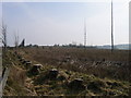
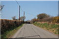
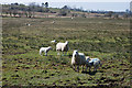
Photos of Llangwyryfon Community
Area Information
Llangwyryfon Community encompasses a substantial fifty-two per cent of the total parish landmass, covering an area of thirty-one point nine square kilometres. This civil parish offers a rural setting where space is ample and the built environment is spread out over the landscape. The area functions as a quiet community where daily life revolves around proximity to nature rather than high-density urban centres. You will find a distinct lack of planning constraints that typically restrict development in more sensitive locations. There are no Ramsar wetland sites or Areas of Outstanding Natural Beauty within the parish boundaries. Similarly, there is no protected nature reserve coverage imposing additional restrictions on land use. While protected woodland does exist within the area, the overall risk score indicates these sites represent a minimal planning constraint. Living in Llangwyryfon Community means accepting a slower pace of life in exchange for significant open space and environmental openness. The layout supports a dispersed lifestyle rather than a compact village model. Prospective buyers should expect a setting defined by its size and the relative freedom from complex conservation limitations that characterise other parts of Wales. This dynamic creates a straightforward environment for understanding the land, its regulations, and its potential for settlement.
- Area Type
- Parish
- Area Size
- 31.9 km²
- Population
- Not available
- Population Density
- Not available
Demographics
The population profile in Llangwyryfon Community reveals a community dominated by older residents. The median age stands at exactly seventy years, a figure that categorises this parish as one of the oldest places in the UK. This demographic skew influences the character of daily life, shops, and social infrastructure in the area. The most common age range recorded is simply listed as total, suggesting a broad distribution without a narrow youth focus. Home ownership is entrenched in this community, with seventy-nine per cent of households owning their property outright or with a mortgage. This high rate of ownership contrasts sharply with student-heavy or high-rental zones found elsewhere. Households are defined by their composition data, which indicates a standard spread across the total population rather than a specific concentrated family type. Accommodation types follow a similar pattern of generalised distribution across the total stock. Diversity in this area is non-existent in terms of predominant ethnicity, as no specific group holds a majority share that defines the cultural landscape. Religion data is similarly unbroken, meaning no single faith forms a numerical baseline for the community. The absence of deprivation data further isolates this area from statistical comparisons with wealthier or poorer neighbour parishes.
Household Size
Accommodation Type
Tenure
Ethnic Group
Religion
Household Composition
Age
Household Deprivation
NS-SEC
Explore more demographic insights in this area
Go to Demographics tabPlanning
Planning Constraints
- Flood RiskPremium
- Ramsar Wetland SitesPremium
- Area of Outstanding Natural BeautyPremium
- Protected Nature ReservePremium
- Protected WoodlandPremium
- Crime RiskPremium