Area Overview for Tregaron Community
Photos of Tregaron Community
Area Information
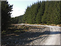
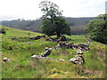
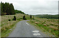
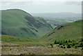
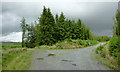
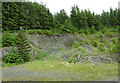
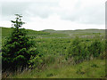
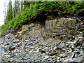
Living in Tregaron Community offers a distinct rhythm of life within a civil parish that covers 86.4 km² of rural Wales. This area is defined by its substantial landmass rather than dense urbanisation, creating spaces where nature and settlement coexist. You will find that daily life here moves at a pace dictated by the surroundings rather than the constraints of a busy city centre. The community structure supports a quieter existence, away from the high-traffic corridors often found in larger settlements nearby. The parish environment is large enough to contain varied landscapes yet small enough to maintain local character. Residents navigate a region where the distance between points is measured in kilometres, reflecting the expansive nature of this settlement. This spatial spread defines the practicalities of living here, from the time taken to reach amenities to the distance walked between natural features. The area does not offer the compact convenience of town living, but it provides a breadth of environment that appeals to those seeking space. Visitors and new residents often appreciate the clear distinction of this local government classification. The designation as a civil parish underscores its administrative and social identity within the wider county. You navigate Tregaron Community knowing exactly what boundaries define your home and local services. This clarity simplifies understanding of local governance and community responsibilities. The region stands apart from urban centres by prioritising space and natural setting over density and traffic flow.
- Area Type
- Parish
- Area Size
- 86.4 km²
- Population
- Not available
- Population Density
- Not available
Demographics
The community profile of Tregaron Community reveals a population that skews significantly towards later life stages. A median age of 70 years indicates that the residents are predominantly seniors. You will find that the area is not built for a young workforce or families with small children. The demographic weight is heavily concentrated in the older age bracket, which shapes the social fabric and local priorities. This age distribution suggests a neighbourhood where retirement living or long-term residency is the norm. Home ownership stands at 71%, which is a very high proportion for the region. This statistic confirms that the housing stock is largely vested in the residents rather than available for private rent. You are looking at an established market where most occupants own their properties outright or with a mortgage. Very high ownership rates often correlate with areas that appeal to retirees or those buying for stability. The implication for buyers is clear: you are entering a property market that functions differently from urban rental hubs. Diverse household compositions exist within this framework, though the dominant trend follows the age data. The area maintains a simple social structure without complex demographic overlaps. Ethnic diversity and religious breakdowns follow the standard patterns for this type of rural parish in Wales. Crime risk data is currently only available for areas in England, so local safety assessments rely on other factors. The deprivation index supports a relatively stable standard of living consistent with the high ownership levels. Residents here benefit from a society where property tenure and age are the defining characteristics.
Household Size
Accommodation Type
Tenure
Ethnic Group
Religion
Household Composition
Age
Household Deprivation
NS-SEC
Explore more demographic insights in this area
Go to Demographics tabPlanning
Planning Constraints
- Flood RiskPremium
- Ramsar Wetland SitesPremium
- Area of Outstanding Natural BeautyPremium
- Protected Nature ReservePremium
- Protected WoodlandPremium
- Crime RiskPremium