Area Overview for Trefeurig Community
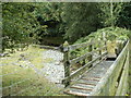
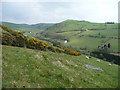
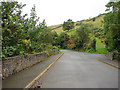
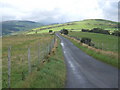
Photos of Trefeurig Community
Area Information
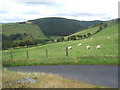
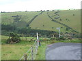
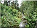
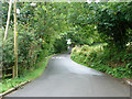
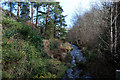
Trefeurig Community sits as a civil parish covering an area of 26.2 km² in Wales. You will find this parish is characterised by rural living rather than urban density. The landscape here is defined by open spaces and natural features, existing away from major cities. This setting makes the parish distinct from typical suburban developments where people often live. You are stepping into an environment where space is your primary asset. The structure of the area suggests a quiet way of life for anyone considering homes in Trefeurig Community. There are no high-rise structures or dense housing blocks dominating the view. Instead, the parish offers a spread-out arrangement that suits those seeking room to breathe. The geography supports a slower pace of daily life compared to council estates or town centres. You will encounter a sense of established localness rather than a rapidly changing neighbourhood. The sheer size of the parish gives you room to move without congestion. This layout appeals to buyers who want distance from industrial noise and traffic.
- Area Type
- Parish
- Area Size
- 26.2 km²
- Population
- Not available
- Population Density
- Not available
Demographics
The people residing in Trefeurig Community reflect a settlement with a mature population character. A significant proportion of the residents fall into the older age bracket, a feature typical of many established Wales parishes. The median age stands at 70 years, indicating a community where life experiences have naturally accumulated. You will find households here are likely to consist of individuals or established families rather than young professionals. Home ownership defines the residential landscape with 83% of the population owning their property. This high figure signals a long-term commitment to the local area by current residents. You can expect stability in the neighbourhood because people invest their own capital into maintaining these homes. The accommodation types and household composition suggest a settled community structure. There is minimal turnover of residents which fosters strong local knowledge and neighbourly relations. When you look at living in Trefeurig Community, you are entering an environment of permanence. The demographic profile supports a quiet society where children and families are a minority compared to older adults.
Household Size
Accommodation Type
Tenure
Ethnic Group
Religion
Household Composition
Age
Household Deprivation
NS-SEC
Explore more demographic insights in this area
Go to Demographics tabPlanning
Planning Constraints
- Flood RiskPremium
- Ramsar Wetland SitesPremium
- Area of Outstanding Natural BeautyPremium
- Protected Nature ReservePremium
- Protected WoodlandPremium
- Crime RiskPremium