Area Overview for Tirymynach Community
Photos of Tirymynach Community

Area Information
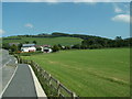
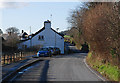
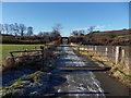
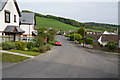
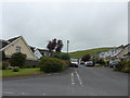
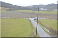
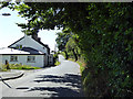
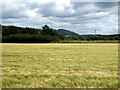
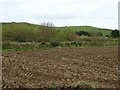
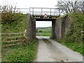
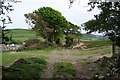
Tirymynach Community is a civil parish covering an area of 14.9 km² in Wales. This compact size creates a close-knit environment where residents interact frequently. Living in Tirymynach Community means experiencing a settlement defined by its rural character and established boundaries. The parish offers a specific type of Welsh countryside living that differs significantly from urban centres. You will find a location where the natural landscape forms the primary backdrop to daily life. The area relies on its proximity to local amenities rather than major transport hubs or city centres. Homes in Tirymynach Community sit within a landscape that balances residential space with natural features. Residents here enjoy a slower pace of life while retaining access to essential services. The distinct identity of this parish provides a clear sense of place for anyone considering moving to the area. Your daily commute and leisure activities will revolve around this compact, well-defined territory. The community does not sprawl; instead, it concentrates its population and housing in a manageable footprint. This geographical fact shapes everything from local council services to social organisation within the parish. You are moving to a place where boundaries are clear and the population is settled.
- Area Type
- Parish
- Area Size
- 14.9 km²
- Population
- Not available
- Population Density
- Not available
Demographics
The demographic profile of Tirymynach Community reveals a population centred on older residents, with a median age of 70 years. This age distribution indicates that the neighbourhood is home primarily to retirees and long-standing families rather than young professionals or transient workers. The age data suggests a community where life expectancy and generational stability are high priorities. Home ownership stands at 70%, which creates a stable voting bloc and a resident base with significant financial investment in the local area. This high rate of ownership contrasts sharply with younger urban areas where tenancy is common. You will find that most households in Tirymynach Community own their property outright or have a mortgage for a considerable period. The household composition reflects this older demographic, likely featuring more single-person homes or households with older couples. Accommodation types in the parish align with the needs of an ageing population, potentially including larger family homes adapted over time. Predominant ethnicity and religion data are not specified in the current records, so the community largely presents as a general Welsh demographic without specific sub-grouping visible in available metrics. Deprivation data is absent from the provided statistics, meaning you cannot currently assess wealth distribution or poverty rates within the parish. Instead, the 70% home ownership rate serves as the primary indicator of the area's economic standing. Every claim about the residents relies on these exact figures to define the community's character.
Household Size
Accommodation Type
Tenure
Ethnic Group
Religion
Household Composition
Age
Household Deprivation
NS-SEC
Explore more demographic insights in this area
Go to Demographics tabPlanning
Planning Constraints
- Flood RiskPremium
- Ramsar Wetland SitesPremium
- Area of Outstanding Natural BeautyPremium
- Protected Nature ReservePremium
- Protected WoodlandPremium
- Crime RiskPremium