Area Overview for Llanwenog Community
Photos of Llanwenog Community
Area Information
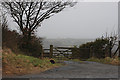
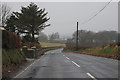
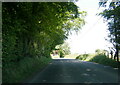
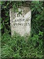
Llanwenog Community is a distinct unitary electoral division situated in Wales, covering a total land area of 45.1 square kilometres. Living in this area means being part of a settled environment where the landscape and local infrastructure are defined by clear planning boundaries. The community occupies a specific geographic footprint that separates it from surrounding regions, offering residents a defined local identity. Daily life here revolves within these parameters, where the scale of the local authority aligns with the physical expanse of the land. You will find that the area provides a structured setting for households, with the boundaries clearly marked as an electoral division. This administrative status influences how services are delivered and how local decisions are made regarding the 45.1 square kilometres under your consideration. The definition of the neighbourhood centres on these established limits, creating a consistent framework for anyone looking at homes in Llanwenog Community.
- Area Type
- Parish
- Area Size
- 45.1 km²
- Population
- Not available
- Population Density
- Not available
Demographics
The population profile of Llanwenog Community indicates a mature demographic, with a median age of 70 years. This figure suggests a population heavily weighted towards senior residents, shaping the social fabric and economic activity within the area. When considering who lives here, you should expect an older demographic that influences local demand for services and community engagement. The age distribution reflects a community where families with young children may be less prevalent compared to older couples or individuals. Data on household composition and specific ethnic groups is not available in the current records, meaning you must rely on this age statistic as a primary indicator of the community character. Similarly, detailed breakdowns of religion and specific ethnic predominance are not provided, limiting the depth of cultural analysis. You must interpret the high median age as the defining feature when reviewing the socio-economic environment of Llanwenog Community. This age profile impacts how you might fit into the local culture and whose company you may keep in public spaces.
Household Size
Accommodation Type
Tenure
Ethnic Group
Religion
Household Composition
Age
Household Deprivation
NS-SEC
Explore more demographic insights in this area
Go to Demographics tabPlanning
Planning Constraints
- Flood RiskPremium
- Ramsar Wetland SitesPremium
- Area of Outstanding Natural BeautyPremium
- Protected Nature ReservePremium
- Protected WoodlandPremium
- Crime RiskPremium