Area Overview for Llandysul Community
Photos of Llandysul Community
Area Information
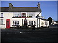
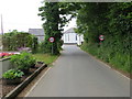
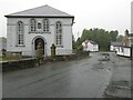
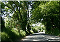
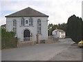
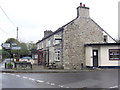
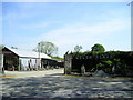
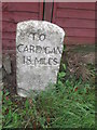
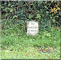
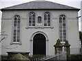
Llandysul Community stands as a small market town in south Ceredigion, West Wales, situated within the valley of the River Teifi. This civil parish covers an area of 66.7 km² and sits at the boundary with Carmarthenshire, approximately eight miles east of Newcastle Emlyn. The town derives its name from the Church of St Tysul, a dedication to a sixth-century British saint. While the village core comprises 1,484 residents, the wider community host population of 2,732. This historical setting shapes daily life around a riverside environment and a strong heritage focus. The community retains a distinct character as a rural market town with links to the past. Llandysul functions as a hub for local life, hosting weekly markets every Thursday. The town's identity is forged through its industrial history, its role in publishing via Gwasg Gomer, and its deep nonconformist history evidenced by numerous chapels. Families considering homes in Llandysul face a tapestry of opportunity rooted in tourism, notably for fishing and canoeing on the Teifi, alongside traditional agricultural activities. Living in Llandysul offers a grounded experience where the river defines the landscape and history informs the streets. You will find a community shaped by its conservation area status and twinning with Plogonnec in Brittany, France, rather than by rapid modern development.
- Area Type
- Parish
- Area Size
- 66.7 km²
- Population
- Not available
- Population Density
- Not available
Demographics
The demographic profile of Llandysul Community reveals a distinct shift towards older age. The median age in the area is 70, indicating a predominantly senior population. This contrasts with younger urban centres, suggesting a retirement hub or a village retaining an older demographic structure. In terms of housing tenure, 71% of households own their homes outright or with a mortgage. This high level of home ownership is a defining feature of living in Llandysul, pointing towards a settled population rather than a transient rental market. Household composition and accommodation types reflect the needs of this older demographic. While specific breakdowns of family sizes or single-person households are not detailed in the available records, the overall age profile strongly suggests a decline in young families with minor children. The area's population of 2,732 remains relatively stable, suggesting a consistent demand for housing that suits those in later life stages. Diversity data and specific religion breakdowns are not quantified for this parish, but the overall character remains firmly Welsh. A homebuyer should expect a quiet environment where the rhythm of daily life has slowed, aligning with the traditional pace of a rural market town rather than a fast-growing commuter belt.
Household Size
Accommodation Type
Tenure
Ethnic Group
Religion
Household Composition
Age
Household Deprivation
NS-SEC
Explore more demographic insights in this area
Go to Demographics tabPlanning
Planning Constraints
- Flood RiskPremium
- Ramsar Wetland SitesPremium
- Area of Outstanding Natural BeautyPremium
- Protected Nature ReservePremium
- Protected WoodlandPremium
- Crime RiskPremium