Area Overview for Llandyfriog Community
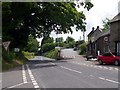
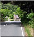
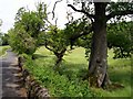
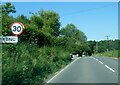
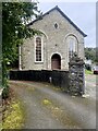
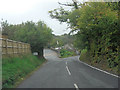
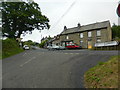
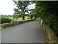
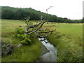
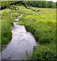
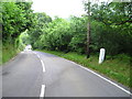
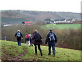
Photos of Llandyfriog Community
Area Information
Living in Llandyfriog Community offers a distinct experience defined by its status as a civil parish with a total area of 29.8 km². You will find a setting that balances rural attributes with established living quarters, situated entirely within Wales. The location provides a defined boundary for those seeking a specific type of neighbourhood without the constraints of larger urban sprawl. Daily life here revolves around the intimate scale of the parish, where the physical landscape shapes your interactions with the environment. The area size ensures you are not living in a dense city centre, yet the defined borders create a clear sense of place. This location serves as a solid foundation for homebuyers who understand the value of a recognised administrative unit. Your perspective of the surroundings will be consistent and predictable, lacking the uncertainty that comes from unincorporated zones. The character of Llandyfriog Community remains stable, offering a backdrop where the pace of life is dictated by the local topography rather than heavy development. You can move here knowing the geographical scope exactly what you are entering.
- Area Type
- Parish
- Area Size
- 29.8 km²
- Population
- Not available
- Population Density
- Not available
Demographics
The social fabric of Llandyfriog Community is characterised by an older population, with a median age of 70 years. This demographic profile indicates that the majority of residents fall within an older age bracket, shaping the local demand for specific amenities to suit older adults. Home ownership stands at a high level of 75%, signifying that three out of four households own their living space. This statistic suggests a community where residents are likely to have a long-term stake in their local area, influencing the stability of the neighbourhood. The predominant household composition reflects this settled nature, though specific breakdowns by age group or family size are not detailed in current records. Accommodation types mirror the ownership trends, with most dwellings likely reflecting the needs of established residents rather than transient populations. Diversity and religious affiliation data are not currently provided, but the high ownership rate implies a tightly knit group of neighbours who have stayed put. You should consider whether an older demographic aligns with your expectations for future community activities and local services. The area does not experience the rapid population turnover common in younger urban zones, creating a slower, more established rhythm to daily interactions.
Household Size
Accommodation Type
Tenure
Ethnic Group
Religion
Household Composition
Age
Household Deprivation
NS-SEC
Explore more demographic insights in this area
Go to Demographics tabPlanning
Planning Constraints
- Flood RiskPremium
- Ramsar Wetland SitesPremium
- Area of Outstanding Natural BeautyPremium
- Protected Nature ReservePremium
- Protected WoodlandPremium
- Crime RiskPremium