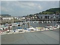
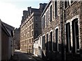
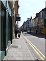
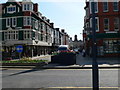
Area Overview for Aberystwyth Community
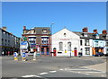
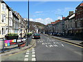
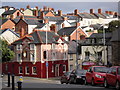
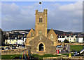
Photos of Aberystwyth Community
Area Information
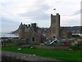
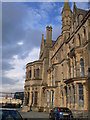
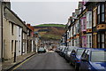
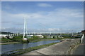
Aberystwyth Community is a defined civil parish situated in Wales, covering a total area of 5.7 square kilometres. You will find 2,587 residents calling this small settlement home, creating a population density of 453 people per square kilometre. Living in Aberystwyth Community offers a distinct experience due to its compact size and moderate population figure. This specific parish profile shapes a neighbourhood where residents are likely to know each other, given the limited boundaries. The area functions as a residential hub within the wider local governance structure of Wales. When considering homes in Aberystwyth Community, you are entering a space with clear geographical limits. The single name designation simplifies the search process, yet it encapsulates a diverse range of living situations. Daily life here revolves around a community that balances urban amenities with the constraints of a smaller parish. The lack of complex sub-divisions means planning and local services focus on this single entity. You can expect a straightforward administrative structure when dealing with local council matters. The physical dimensions of 5.7 km² constrain development while preserving a sense of place for current inhabitants.
- Area Type
- Parish
- Area Size
- 5.7 km²
- Population
- 2587
- Population Density
- 453 people/km²
Demographics
The demographic profile of Aberystwyth Community reveals a mature population with a significant implication for daily life. The median age stands at 70 years, which indicates a large proportion of older adults reside here. This figure suggests that homes in Aberystwyth Community often cater to those seeking retirement or semi-independent living. The total household composition data spans the entire parish, providing a complete picture of family units and single occupants. You will encounter a mix of family homes and residences for the elderly within this parish boundary. Regarding ownership, 43% of residents own their homes outright or with a mortgage, while the remainder reside in rental properties. This relatively low ownership rate compared to older rural parishes might indicate a higher proportion of student accommodation or rental lets associated with the nearby university or holiday lets. The total accommodation type data covers every dwelling style present in the parish. Diversity in ethnic groups is recorded in the total representative sample, reflecting the modern reality of life in Aberystwyth Community. These figures help you understand who your neighbours might be and the culture of the local shops. The age skew toward older demographics suggests specific needs for local healthcare and leisure facilities might be prioritised by community groups.
Household Size
Accommodation Type
Tenure
Ethnic Group
Religion
Household Composition
Age
Household Deprivation
NS-SEC
Explore more demographic insights in this area
Go to Demographics tabPlanning
Planning Constraints
- Flood RiskPremium
- Ramsar Wetland SitesPremium
- Area of Outstanding Natural BeautyPremium
- Protected Nature ReservePremium
- Protected WoodlandPremium
- Crime RiskPremium